A reasonably undisturbed natural area which is best described as being very wet. Best visited in late fall or in winter when the southern portion is accessible.
Only the top, north portion, of Parkland Natural Area was visited. The remaining southern portion proved to be too wet to access. A winter return is in order. As noted below, this site has a good number of newer signs but all located on the eastern border along RR 201.
Inspection Report
| Question | Q## | Response |
| General Information | ||
| Date/Site/Submitter: | Q21/22/12 | 2023-10-08: Parkland; Phrank P. |
| Guest Names | Q14 | Frank Potter |
| SAPAA Member | Q16 | Yes |
| Over all Impression of the Site | ||
| What is the Naturalness of the Site? 4=Great, 0=Terrible | Q31 | 4 – Great |
| How Natural?: comments | Q32 | A reasonably undisturbed natural area which is best described as being very wet. Best visited in late fall or in winter when the southern portion is accessible. Much of this natural area is wet. An east west right of way runs across its northern border. This trail follows some high ground south of Township Road 512 and interconnected wetlands which parallel this road. |
| How was your visit to the PA? | ||
| Trip Duration | Q41 | 1-2 hours |
| Why Did you Go? | Q42 | Other (see comments) |
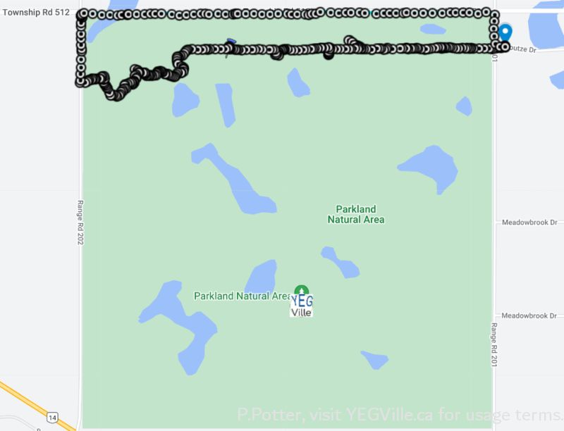
| Visit Details | Q43 | Prepare a YEGVille.ca site report. Started in the NE corner (RR 201), walked west along a cut line within the NA. Exited at RR 202 and returned along the roadways (see map). |
| What is in the Site? | ||
| Ease to Visit | Q51 | Other (see comments) |
| Biological Observations | Q52 | Lots of beaver activity. Room for 2-4 cars on RR 201. |
| Submissions to iNaturalist | Q53 | No, did not see anything of note |
| Geological Observations | Q54 | None noted. |
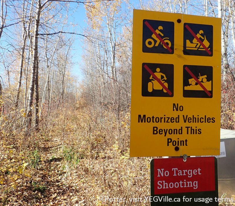
| Designation as a Protected Area | Q55 | Signage, Fencing |
| Comments | Q56 | The east side of the natural area has nearly a half dozen signs. Only one weather beaten sign in the southwest corner. |
| Human Activities/Disturbances | ||
| Agricultural Activities | Q61 | None noted |
| Resource extraction | Q62 | None Noted |
| Motorized disturbances (ATV or vehicle activity). | Q63 | None Noted |
| Animal or self propelled activities | Q64 | Hiking Trails, Other (see comments) |
| Gathering and Dumping Activities | Q65 | None Noted |
| Infrastructure encroachment | Q66 | None Noted |
| Comments | Q67 | While on the site, heard shots from the south. Likely game bird hunting in the southern portion. |
| What Needs to be Done? | ||
| Remediation/Protection Activities Needed | Q71 | Nothing, all good |
| What Have you Done Recently to Help the site? | Q72 | Visit and Submitted This Report! |
| Nearby Stewards? | Q73 | There are two estate communities to the east which are potential stewards. There are active Stewards for the NA. |
| Comments | Q74 | Much of this natural area is wet. An east west right of way runs across its northern border. This trail follows some high ground south of TWP 512 and interconnected wetlands which parallel this road. One Dodgy Bit of this trail is where it dips down to a stream connecting the wet lands on either side of the trail. Two logs provided a foot bridge. Otherwise, a visit in early fall, 2023 kept me mostly on this trail as any attempts to head south would have been sodden. Slight Detour South along the western portion of the trail. This is necessitated by the wet lands off the township road pushing into the corridor. Trail Not Taken describes a route striking off to the southeast from RR 202. Shots were heard when exploring the area so there may be duck blinds, etc. in the area. New Boundary Signs, suggests that this area is being actively managed. A drive around the west, east, and north borders showed no obvious ATV ingress. With the undisturbed nature and wetlands, likely this is a favourite spot for birders and hunters alike. Winter Destination is the rating for this site as it would probably yield many of its secrets when the wetlands are frozen and thus accessible by snowshoe. (adapted from a YEG-Ville site visit). |
| Last Words | Q82 | In good shape and likely good for birders, botanical field worker, and winter activities. |
Sound File
The Government of Alberta’s Chief Scientist office requests that we collect a sound recording from sites. Not much to hear, which is a good thing! Collected 2023-10-08, 1351h, coordinates provided in the sound file.
Images from Inspection

Marsh at the western terminus of the trail running through Parkland Natural Area, October 8, 2023, P. Potter. 
Wide track running east-west in the norther portion of Parkland Natural Area, October 8, 2023, P. Potter. 
Foot traffic heading south into the wet areas of Parkland Natural Area, October 8, 2023, P. Potter. 
Wetlands making up most of the Parkland Natural Area, October 8, 2023, P. Potter. 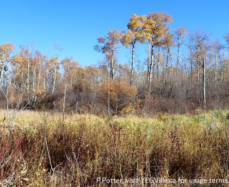
Vibrant autumn colours, Parkland Natural Area, October 8, 2023, P. Potter. 
A tale of two roads. The watery one made by beavers and the distant one Township Road 512. Looking north from Parkland Natural Area, October 8, 2023, P. Potter. 
Beaver dam in the middle of the road side wet area, looking south from Township Road 512 into Parkland Natural Area, October 8, 2023, P. Potter. 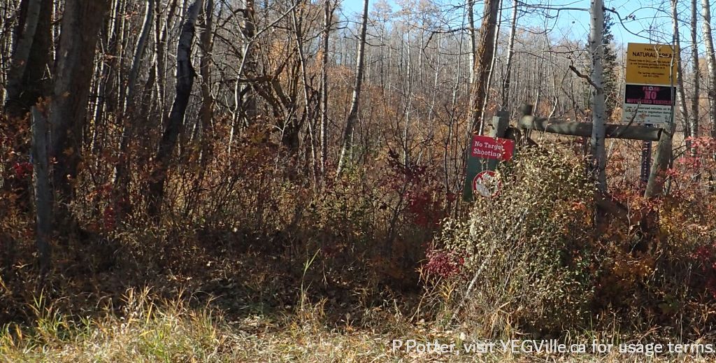
Signage about Parkland Natural Area, October 8, 2023, P. Potter. 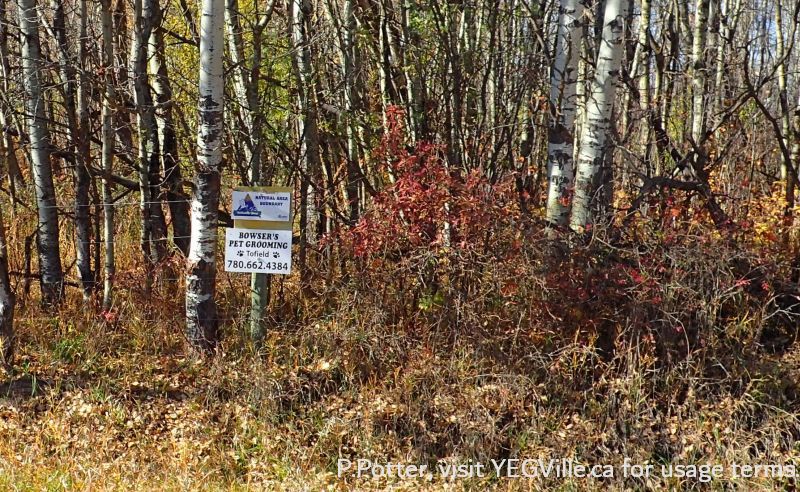
Boundary Sign playing double duty, Parkland Natural Area, October 8, 2023, P. Potter. 
Newer boundary signs, Parkland Natural Area, October 8, 2023, P. Potter. 
Newer signs on the northeastern border of Parkland Natural Area, October 8, 2023, P. Potter. 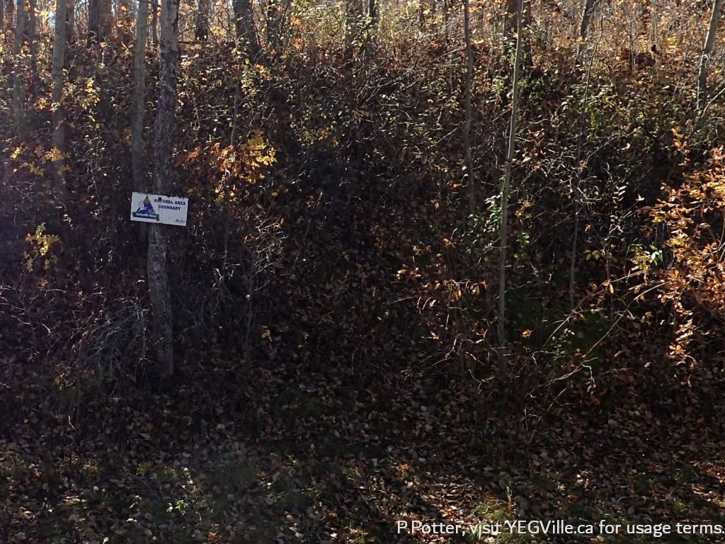
Boundary sign, Parkland Natural Area, October 8, 2023, P. Potter.
