Heavily disturbed natural area and the only one (so far) deserving of a score of “0” for Naturalness, a rating of ‘Terrible’.
The Redwater River Natural Area, as of 2024-03-29, is heavily disturbed by ATV tracks, an illegal gun range, and dumping sites, posing safety risks and environmental damage. Remediation activities like signage, cleanup, and ongoing monitoring are urgently needed. This site requires immediate attention due to extensive abuse and neglect.

Inspection Report
| Question | Q## | Response |
| General Information | ||
| Date/Site/Submitter: | Q21/22/12 | 2024-03-29: Redwater River; Phrank P. |
| Guest Names | Q14 | Frank Potter |
| SAPAA Member | Q16 | Yes |
| Over all Impression of the Site | ||
| What is the Naturalness of the Site? 4=Great, 0=Terrible | Q31 | 0 – Terrible |
| How Natural?: comments | Q32 | A site that has been partially destroyed through bush parties, ATVs, and an illegal gun range. Visit with extreme caution. |
| How was your visit to the PA? | ||
| Trip Duration | Q41 | 1-2 hours |
| Why Did you Go? | Q42 | Other (see comments) |
| Visit Details | Q43 | Visit while researching for yegville.ca. |
| What is in the Site? | ||
| Ease to Visit | Q51 | Parking lot or parking for 2 or more cars |
| Biological Observations | Q52 | The western portion, most affected by ATV traffic was devoid of fresh animal tracks (rodent, ungulate) or scat. Only when I moved away from the illegal gun range area were there some older deer and hare tracks. One tree was stripped of bark, unclear of the animal doing the munching. |
| Submissions to iNaturalist | Q53 | No, did not see anything of note |
| Geological Observations | Q54 | Nothing of note |
| Designation as a Protected Area | Q55 | Exists but in disrepair |
| Comments | Q56 | A single boundary sign on RR230. |
| Human Activities/Disturbances | ||
| Agricultural Activities | Q61 | None noted |
| Resource extraction | Q62 | None Noted |
| Motorized disturbances (ATV or vehicle activity). | Q63 | Off Highway Vehicles (e.g. quads, motorbikes) |
| Animal or self propelled activities | Q64 | Other (see comments) |
| Gathering and Dumping Activities | Q65 | Camping (lean-to’s, fire rings, etc.), Bush party sites (e.g. bottles), Recent fires or burns, Garbage dumping |
| Infrastructure encroachment | Q66 | None Noted |
| Comments | Q67 | This NA is heavily disturbed. The extensive ATV tracks makes for easy walking but the impromptu gun range makes getting shot easier still. |
| What Needs to be Done? | ||
| Remediation/Protection Activities Needed | Q71 | Fencing, Re-vegetation, Cleanup, Signs, Continued Monitoring, Educating Neighbours about Site Usage |
| What Have you Done Recently to Help the site? | Q72 | Visit and Submitted This Report! |
| Nearby Stewards? | Q73 | 59103 Range Road 230, the Marr’s Farm |
| Comments | Q74 | This site has suffered significant abuse and is in desperate need of a clean up, fencing, signage, and ongoing monitoring. About six different dumping sites were noted with some tree cutting. Beyond trails, ATVs have created ‘donut’ pits in which a 100M+ area has been stripped of vegetation as a result of the circular direction of travel by vehicles. Most worrisome is the gun range set up roughly at 54.075577, -113.298419. The ground is littered with spent shell casings, skeet targets, and the back stop of trees seems to have been shot down (rather than cut down). Beyond the potential lead in the shot, this is an extreme safety risk for visitors. The direction and apparent inexperience of those using the firearms could give rise to accident shootings. |
| Last Words | Q82 | Shooting and dumping is widespread throughout the area. |
Sound File
The Government of Alberta’s Chief Scientist office requests that we collect a sound recording from sites. Not much to hear, which is a good thing! Collected 2024-04-09, 1300h, coordinates provided in the sound file.
Images from Inspection

Looking west along an east-west running boundary trail at the north of Redwater River Natural Area, 2024-03-29, P. Potter. 
Bark stripped tree, likely a tasty snack, Redwater River Natural Area, 2024-03-29, P. Potter. 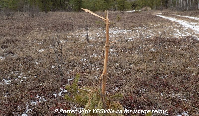
Bark stripped tree, likely a tasty snack, Redwater River Natural Area, 2024-03-29, P. Potter. 
Looking east into the adjoining private property, Redwater River Natural Area, 2024-03-29, P. Potter. 
One of many ATV tracks, this one heading west, Redwater River Natural Area, 2024-03-29, P. Potter. 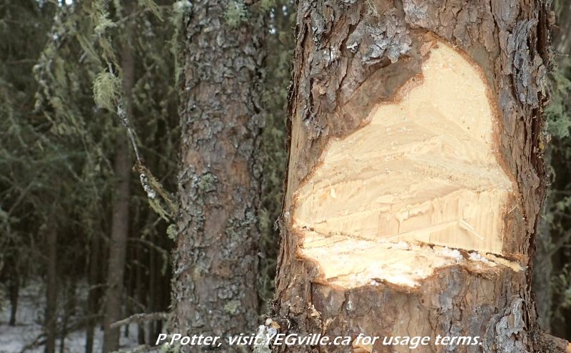
A failed attempt to use an axe, Redwater River Natural Area, 2024-03-29, P. Potter. 
More dumping, Redwater River Natural Area, 2024-03-29, P. Potter. 
An ATV donut-pit with complete soil disturbance, Redwater River Natural Area, 2024-03-29, P. Potter. 
Trees ‘shot down’ in impromptu shooting range, Redwater River Natural Area, 2024-03-29, P. Potter. 
Targets within the impromptu shooting range, Redwater River Natural Area, 2024-03-29, P. Potter. 
Likely what was a sighting table within the impromptu shooting range, Redwater River Natural Area, 2024-03-29, P. Potter. 
A few of the many hundred (thousand?) shell casings in an impromptu shooting range, Redwater River Natural Area, 2024-03-29, P. Potter. 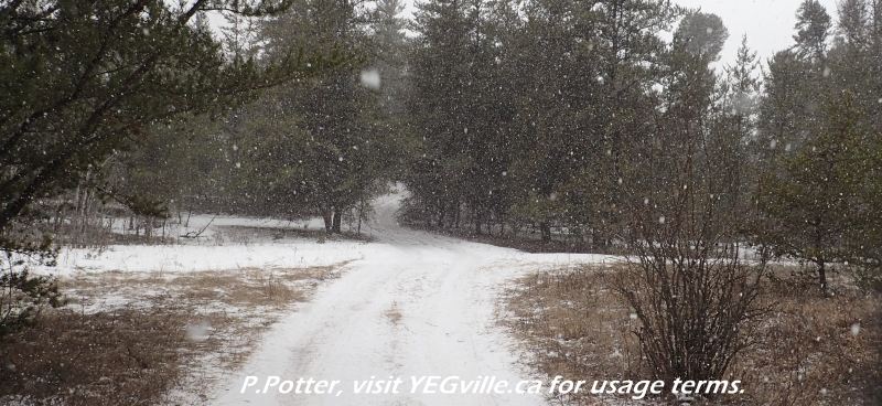
Crisscrossing ATV tracks found throughout Redwater River Natural Area, 2024-03-29, P. Potter. 
First of many instances of garbage dumping in Redwater River Natural Area, 2024-03-29, P. Potter. 
Track heading north from Township road 590 through the adjoining provincial grazing lease south of Redwater River Natural Area, 2024-03-29, P. Potter. 
Wide braided tracks entering ATV track into the NA heading east from RR230, Redwater River Natural Area, 2024-03-29, P. Potter. 
One of ATV track into the NA heading east from RR230, Redwater River Natural Area, 2024-03-29, P. Potter. 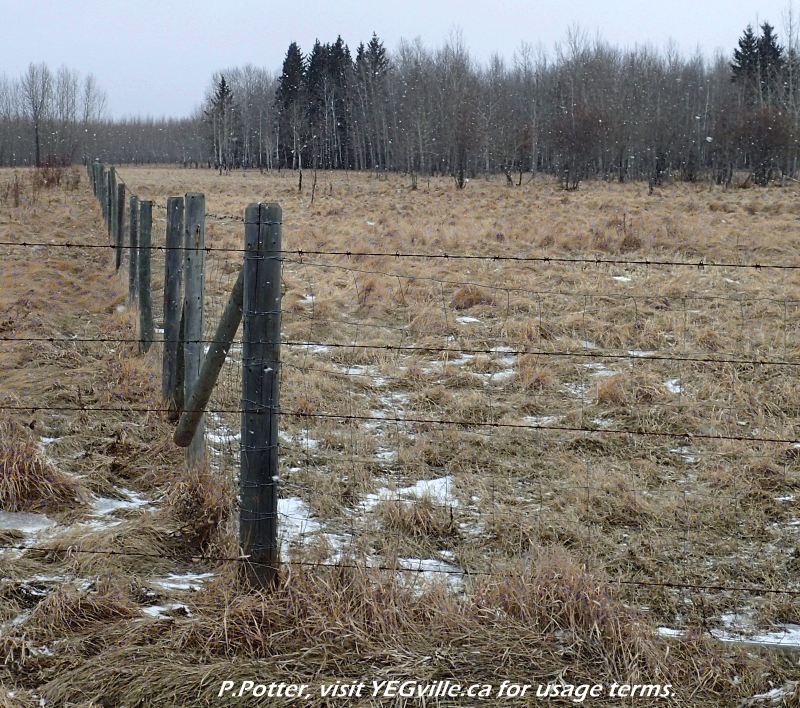
Looking east at the Northwest corner of Redwater River Natural Area, 2024-03-29, P. Potter. 
Site inspection route tracking, Redwater River Natural Area, 2024-03-29, P. Potter.

Pingback: SAPAA Field Trip – April 14, 2024 | SAPAA