The site is remote, characterized by mixed forests and undulating topography. No recent human activities or agricultural impacts were observed.

Inspection Report: 2024-10-16: Eagle Nest (NA); Phrank P.
| Question | Q## | Response |
| General Information | ||
| Date/Site/Submitter: | Q21/22/12 | 2024-10-16: Eagle Nest (NA); Phrank P. |
| Guest Names | Q14 | |
| SAPAA Member | Q16 | Yes |
| Over all Impression of the Site | ||
| What is the Naturalness of the Site? 4=Great, 0=Terrible | Q31 | 4 – Great |
| How Natural?: comments | Q32 | Very little human disturbances noted during a survey walking down the road that bisects the site. This is likely due to its remoteness, and hilly topography. |
| How was your visit to the PA? | ||
| Trip Duration | Q41 | 1-2 hours |
| Why Did you Go? | Q42 | Other (see comments) |
| Visit Details | Q43 | Visited the summer camp of the same name for a YEGVille post, see: https://yegville.ca/2024/10/20/cypress-hills-environ-2024-october/. |
| What is in the Site? | ||
| Ease to Visit | Q51 | None of the Above |
| Biological Observations | Q52 | There are no facilities to support visiting the site nor signs, etc. Mixed forest with a thick understory. Portions were very wet. |
| Submissions to iNaturalist | Q53 | No, did not see anything of note |
| Geological Observations | Q54 | Topography is sharply undulating, The road descends rapidly and cuts through a number of valleys. |
| Designation as a Protected Area | Q55 | None Noted |
| Comments | Q56 | Government style fencing is noted in the SW corner of the site suggesting the site was previously sub-divided. Over grown and disused fencing noted about the same area but on the SE corner and East of the road. |
| Human Activities/Disturbances | ||
| Agricultural Activities | Q61 | None noted |
| Resource extraction | Q62 | None Noted |
| Motorized disturbances (ATV or vehicle activity). | Q63 | Other (see comments, Q67) |
| Animal or self propelled activities | Q64 | None Noted |
| Gathering and Dumping Activities | Q65 | Ad hoc structures (e.g. hunting blinds, bridges, signs, etc.) |
| Infrastructure encroachment | Q66 | Roads |
| Comments | Q67 | A portion of an ATV track is noted on the West side of the road. It has long since fell into disuse and is blocked by fallen trees or overgrowth. A dilapidated bridge is noted. Mostly likely, this track was created as part of the initial survey for the camp above and before the road was constructed. |
| What Needs to be Done? | ||
| Remediation/Protection Activities Needed | Q71 | Nothing, all good |
| What Have you Done Recently to Help the site? | Q72 | Visit and Submitted This Report! |
| Nearby Stewards? | Q73 | Eagles Nest Camp to the North |
| Comments | Q74 | |
| Last Words | Q82 | A beautiful slice of the Cypress Hills with ready access via the road. |
Images from Inspection

Route map, Eagles Nest PNT, 2024-10-16, P. Potter. 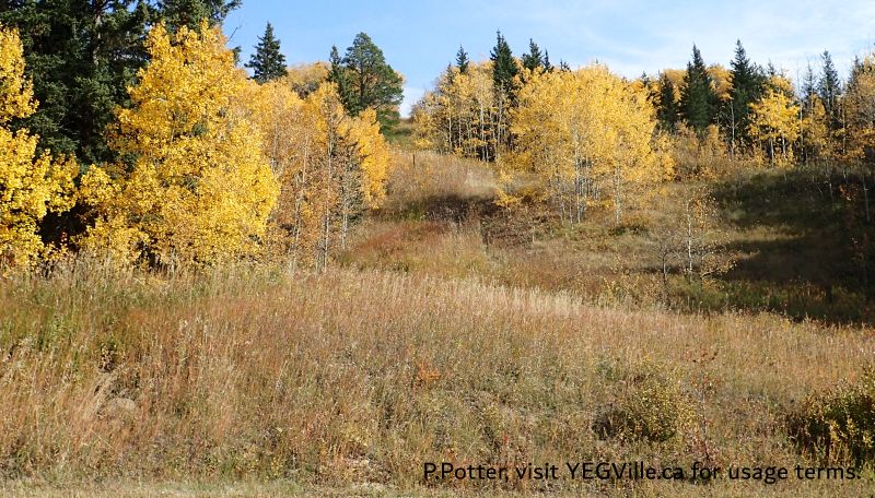
Looking east at the cut line defining the NE border of the site, Eagles Nest PNT, 2024-10-16, P. Potter. 
Looking East across a wet area and a steep valley beyond, Eagles Nest PNT, 2024-10-16, P. Potter. 
About 400 M from the North border, a disused ATV track that roughly runs parallel to the road before petering out, Eagles Nest PNT, 2024-10-16, P. Potter. 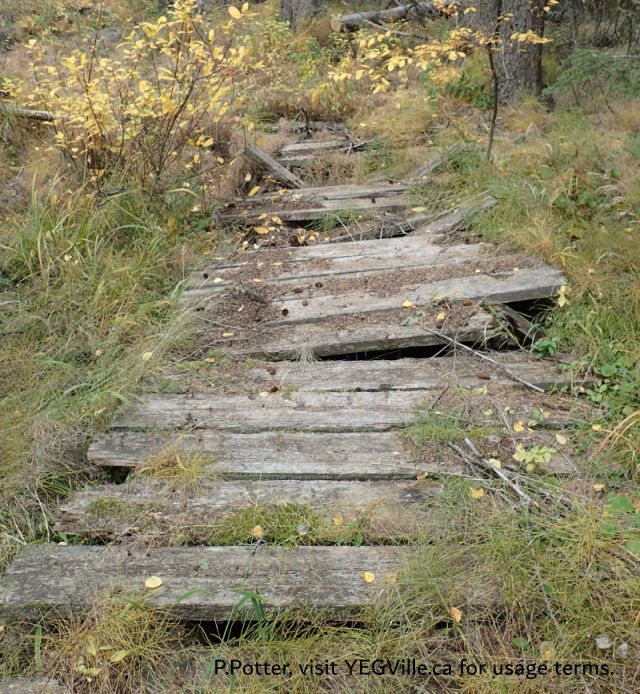
A disused bridge across a wet area; note the cut tree at the top suggesting some maintenance, Eagles Nest PNT, 2024-10-16, P. Potter. 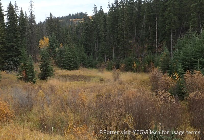
Looking East across a wet area, the boundary of the site is about halfway up the hill in the distance, Eagles Nest PNT, 2024-10-16, P. Potter. 
Handmade sign, looking North, Eagles Nest PNT, 2024-10-16, P. Potter. 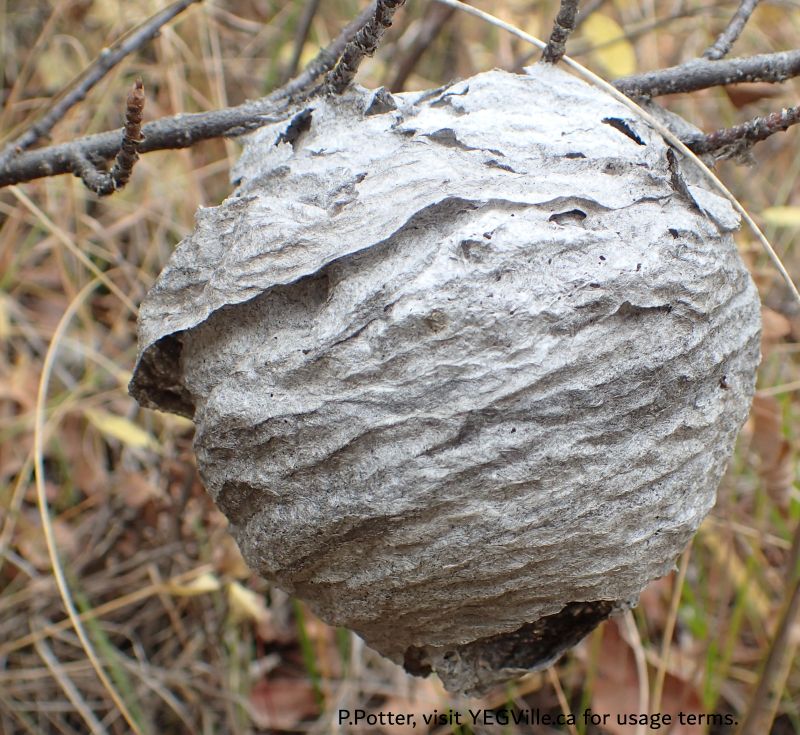
A delicate leftover from the summer, Eagles Nest PNT, 2024-10-16, P. Potter. 
Small wet area formed by the bend of the road; the site boundary is roughly the top of the hill in the background, Eagles Nest PNT, 2024-10-16, P. Potter. 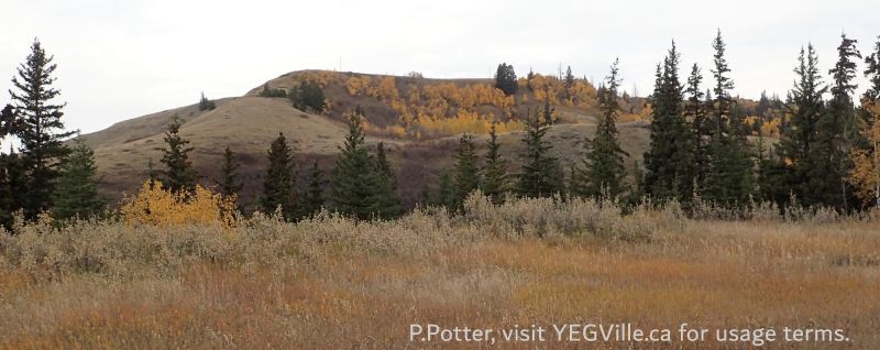
Looking West across a steep ravine and hill beyond, the boundary is roughly the top of the hill in the distance, Eagles Nest PNT, 2024-10-16, P. Potter. 
Looking East at an adjoining property and home on top of the ridge, Eagles Nest PNT, 2024-10-16, P. Potter.
