Tony returns to Snakes Head but this time on the West side of the river. See 2024-10-03: Snakes Head (PNT); Tony B. for his survey of the East side of the Red Deer River.
Inspection Report: 2024-10-14: Snakes Head (NA); Tony B.
| Question | Q## | Response |
| General Information | ||
| Date/Site/Submitter: | Q21/22/12 | 2024-10-14: Snakes Head (PNT) (NA); Tony B. |
| Guest Names | Q14 | Tony Blake |
| SAPAA Member | Q16 | Yes |
| Over all Impression of the Site | ||
| What is the Naturalness of the Site? 4=Great, 0=Terrible | Q31 | 3 |
| How Natural?: comments | Q32 | This part of the NA on the west side of the River gets very little attention from humans. The industrial legacy (oil well, powerline, and access road) is more-or-less abandoned and awaiting reclamation. The most disturbing disturbance is the explosive expansion of Cicer Milkvetch. When I first visited the site twenty years ago there were only a few plants noted on the oil lease. Now it’s present in almost every hectare. |
| How was your visit to the PA? | ||
| Trip Duration | Q41 | half a day (e.g. about 4 hours) |
| Why Did you Go? | Q42 | Visit nature, Hiking, Birding, Plant identification |
| Visit Details | Q43 | Afternoon walk down the escarpment on west side of the NA and then back along the river. |
| What is in the Site? | ||
| Ease to Visit | Q51 | Entrance signs, information, etc., No Amenities |
| Biological Observations | Q52 | The lease road leading to the NWest corner is quite passable, but legal access is a little sketchy since there is no public road allowance connected to the site. Getting up and down the steep 30 meter escarpment takes some SERIOUS scrambling. Aspen/spruce forest the upland portion west of the river escarpment. Diverse vegetation communities below the escarpment ranging from bare river gravel to wetlands to mature spruce forest. It’s interesting to study the effects of beaver dams on the side channels. They trap a lot of sediment and store a lot of water both above and below the surface. For that reason, vegetation on west side of Snakes Head is much more productive and diverse. |
| Submissions to iNaturalist | Q53 | Yes |
| Geological Observations | Q54 | Dominated by a very steep escarpment (~30 m elevation difference). Braided river channels below with numerous springs. |
| Designation as a Protected Area | Q55 | Signage |
| Comments | Q56 | |
| Human Activities/Disturbances | ||
| Agricultural Activities | Q61 | None noted |
| Resource extraction | Q62 | Oil/Gas wells, Hunting or shooting (observed, blinds, spent shell casings, etc.) |
| Motorized disturbances (ATV or vehicle activity). | Q63 | None Noted |
| Animal or self propelled activities | Q64 | None Noted |
| Gathering and Dumping Activities | Q65 | None Noted |
| Infrastructure encroachment | Q66 | Power lines, Roads, Cut lines, Pipelines |
| Comments | Q67 | Heard four well-spaced rifle shots on the east side of the river. Moose hunters? |
| What Needs to be Done? | ||
| Remediation/Protection Activities Needed | Q71 | Re-vegetation, Invasive Weed Removal, Continued Monitoring |
| What Have you Done Recently to Help the site? | Q72 | Visit and Submitted This Report! |
| Nearby Stewards? | Q73 | |
| Comments | Q74 | |
| Last Words | Q82 |
Images from Inspection
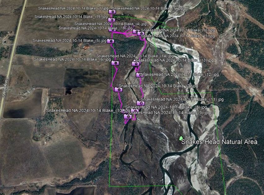
Route map and photos, Snakes Head PNT, 2024-10-14, T. Blake. 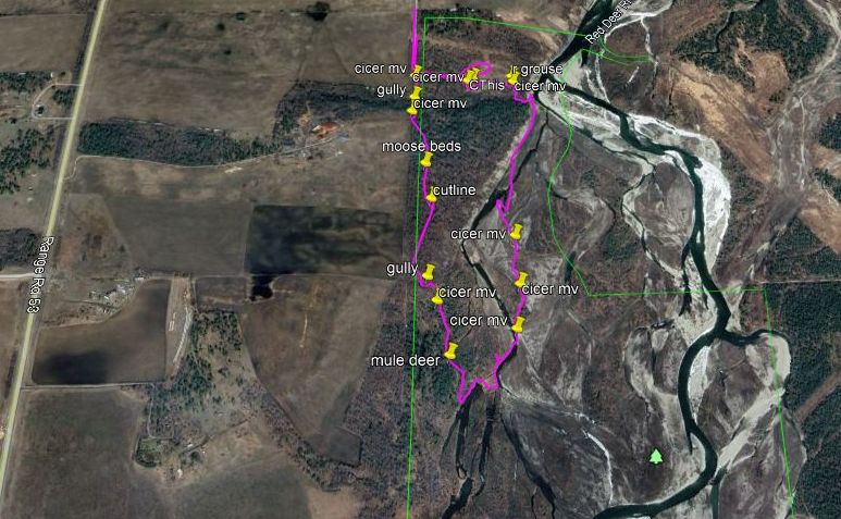
Key sightings and route map, Snakes Head PNT, 2024-10-14, T. Blake. 
View of Snakes Head NA from west-side escarpment; looking SEast, Snakes Head PNT, 2024-10-14, T. Blake. 
River escarpment on the left; beaver activity on a river side channel slows the current and traps silt, looking North, Snakes Head PNT, 2024-10-14, T. Blake. 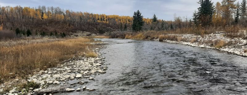
River side channel, note the steep escarpment on the left; looking North, Snakes Head PNT, 2024-10-14, T. Blake. 
Well vegetated river terrace; looking South, Snakes Head PNT, 2024-10-14, T. Blake. 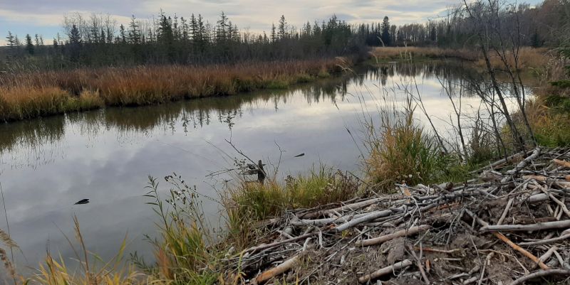
Main beaver pond and lodge, probably spring fed since this pond is located on a terrace a couple of meters above the river; looking South, Snakes Head PNT, 2024-10-14, T. Blake. 
Marshy channel below river escarpment; looking North, Snakes Head PNT, 2024-10-14, T. Blake. 
NWest corner and lease road; looking SEast, Snakes Head PNT, 2024-10-14, T. Blake. 
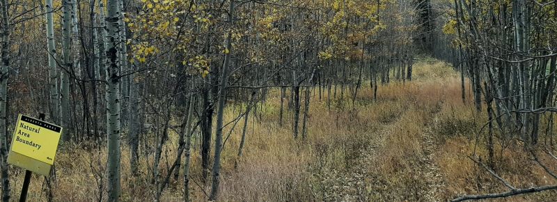
West boundary; looking South, Snakes Head PNT, 2024-10-14, T. Blake. 
Aspen forest above river escarpment; looking SEast, Snakes Head PNT, 2024-10-14, T. Blake. 
Cicer milkvetch climbing a young balsam poplar on a river island; looking West, Snakes Head PNT, 2024-10-14, T. Blake. 
Small beaver blocking the channel; used as a crossing by wildlife; looking East, Snakes Head PNT, 2024-10-14, T. Blake. 
Clematis seed heads, Snakes Head PNT, 2024-10-14, T. Blake. 
Power line for Pine Cliff oil well; looking East, Snakes Head PNT, 2024-10-14, T. Blake. 
Partly dismantled pump-jack. Note power line coming in from the right; looking West, Snakes Head PNT, 2024-10-14, T. Blake. 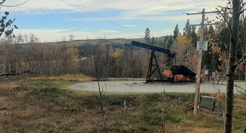
Pine Cliff oil lease (non-producing): looking SEast, Snakes Head PNT, 2024-10-14, T. Blake.
