Return to SAPAA Newsletter No. 57, February 2026.
Sand dune fields in Alberta, Saskatchewan, and Manitoba host unique ecosystems, dominated by jack pine forests and diverse vegetation. While some areas suffer from environmental degradation due to human activities, others maintain ecological integrity and serve as important habitats for wildlife. Community engagement and recreation opportunities are integral to these natural areas.
- Sand Dunes in the Prairies – How Come?
- Natural Vegetation of the Northern Dune Fields
- Bad News for Nature: Natural Areas “Downgraded” to PRAs
- Better News: Natural Areas that Have Kept their Status
- Reference
Sand Dunes in the Prairies – How Come?
There are over 120 sand dune fields in Alberta, Saskatchewan and Manitoba, occurring in both the south, central and north of these Prairie Provinces.1 Their low soil fertility and poor water-holding capacity means they cannot be cultivated and so they form oases of natural vegetation in areas surrounded by agriculture.
Most were formed from sand-bearing sediments carried by rivers issuing from the melting glaciers at the end of the last Ice Age around 11,000 years ago. As the rivers’ currents slowed at lower elevations the heavy sand particles were deposited and then later blown into dune formations by strong winds blowing from the northwest and southeast across open, unvegetated, post-glacial landscapes.1 Wind-blown dunes are referred to as aeolian.
A few dunes are still active today; their expanses of open sand are wind-blown causing them to move slowly across the landscape. The Athabasca Sand Dunes of Alberta and Saskatchewan are the largest active dunes in Canada.
Most dune fields have been stabilized and immobilized by vegetation, however. In southern Alberta the vegetation cover is mostly grass and shrubbery, but the more northern dune fields are forested with jack pine and aspen.
Although they are unsuitable for growing annual crops, they are put to various anthropogenic uses in Alberta. In the south this can be for grazing, or as reserves for military training (e.g., Wainwright and Suffield), while in the north sand dune terrain is exploited by the oil and gas and sand and gravel extraction industries as well as for outdoors recreation. All these uses have greater or lesser degrees of conflict with the ecological integrity of the natural ecosystems.
Natural Vegetation of the Northern Dune Fields
The sandy uplands of the dunes are typically covered by relatively open forests of jack pine with a low or subshrub understory of common bearberry and reindeer lichen, mixed with denser stands of aspen hosting a diverse floral community of medium-tall shrubs and a ground cover of herbaceous plants typical of dry woods.
The vegetation is characteristic and uniform, although diverse, over most of the uplands. However, the rolling topography of the dune fields guarantees that the sandy uplands are invariably associated with interdunal depressions in which water retention results in the development of more organic soils and different plant communities.
These lowlands vary in type and extent and contribute significantly to the biotic diversity of dune field terrain. They can be broad valleys filled with lakes or their associated drier marshes or shrubby meadows or moist deciduous forests, or peatlands with organic soil build-up supporting open sedge fens or dense forests of black spruce and tamarack.
In the Dry Mixedwood subregion of the Boreal Forest Region of Alberta a cluster of dune fields forms a bow-like arc extending from northeast of Edmonton in the area of Bruderheim, north through Redwater, Opal and Halfmoon Lake and on to Clyde, Nestow and Tawatinaw, before curving westward to Holmes Crossing Sandhills Ecological Reserve and Fort Assiniboine Sandhills Wildland Park further northwest in the Central Mixedwood subregion.
The arc encompasses a number of Crown land sites protected as natural areas, which provide opportunities for people living in relatively local urban settlements such as Edmonton to experience nature. Farther north and west the Bear River-Wapiti Sand Dunes complex provides similar opportunities for the residents of Grand Prairie.
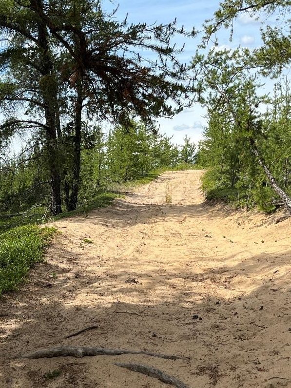
Sites are also visited for passive outdoor recreation such as hiking, horseback riding, snowshoeing or skiing, but motorized recreation using quads, dirt bikes or snowmobiles is arguably much more common. I think it is fair to say that most natural areas are underappreciated by the general public for experiencing nature and/or the outdoors, and they are also little used for educational purposes or research.
In terms of their value as functioning natural ecosystems and for wildlife habitat and movement, because many of these natural areas are small, consisting of a section (259 hectares or 640 acres) or less, this will depend on the amount of surrounding (unprotected) land left in a natural state. Given that these pockets of Crown land are amenable to human disturbance, it is arguable that they may offer less in the way of environmental protection than the surrounding land in private ownership as long as it remains in a natural state.
All naturally vegetated land could be under threat if Canada became more heavily populated and the demands on resources greater. A threat to natural areas that are adjacent to or surrounded by agriculture is the encroachment of weeds. The provincial government does not undertake ecological management of their natural area reserves.
The Problem of “Multi-use” Natural Areas
Since most sand and gravel operations take place outside designated natural areas, and oil and gas installations if they are present have a relatively small footprint, most of the problems of “multi-use” arise from all-terrain vehicle (ATV) traffic.
Well-spaced pine trees with low ground cover on sand means the ground is easily ripped up by machines to make a network of trails; the undulating topography which includes wet hollows provides exactly the kind of challenges the riders are looking for. On the other hand, where tracks through forested areas remain single, and ridership is limited, an ATV trail probably does not do too much ecological harm and does have the advantage of providing access to passive users.
Close to the settled areas ATV use has often been excessive and has been the bane of any citizen stewards appointed by the provincial government when it began its Volunteer Steward Program in 1987. (Stewards’ mandate has largely been to protect the ecological integrity of their areas and their value for nature-based enjoyment.) In some cases, it has been a headache for provincial and municipal governments as well.
Where considerable environmental degradation occurs and it proves impossible to control, it can be an incentive for the government to disestablish (i.e., end protective reservation of) these areas.
Bad News for Nature: Natural Areas “Downgraded” to PRAs
Redwater Natural Area, some 2223 hectares of rolling sandy terrain covered in jack pine forest, was established in 1971 and disestablished as a natural area in 2012, becoming a Provincial Recreation Area dedicated entirely to ATV activity. This happened despite the valiant efforts of the Friends of Redwater Natural Area Society to contain ATV impact, and likely before the government realized the effect of the growing popularity of motorized recreation and the need to provide for it with separate facilities.
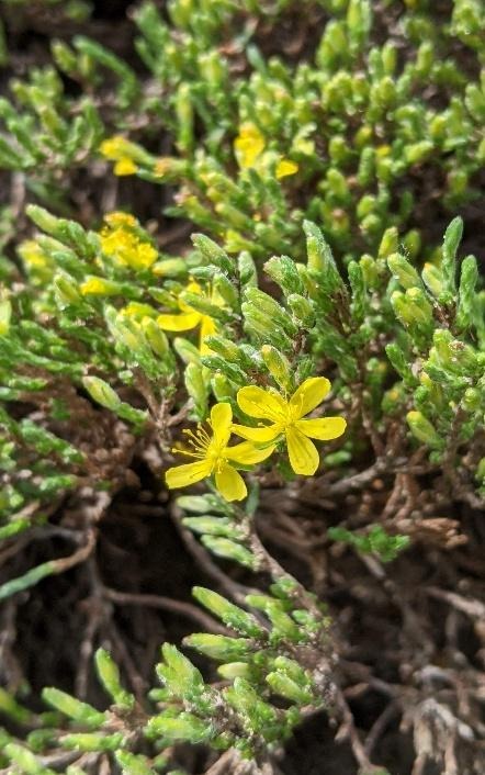
Redwater River Natural Area, also established in 1971, a mere crow’s flight away to the northwest and only a quarter section in size, might have made up for some of its neighbour’s sacrifice of natural terrain, but this too has been chewed up by ATVs. Black spruce trees in its wet depressions do double duty as targets for shooting practice. Nevertheless, Redwater River retains its status as a natural area and has a large population of sand heather (Hudsonia tomentosa), a low, hairy subshrub typical of bare sands but not extremely common. Large tracts of spruce forest to its southeast would suggest that nature is better protected outside this natural area than in.
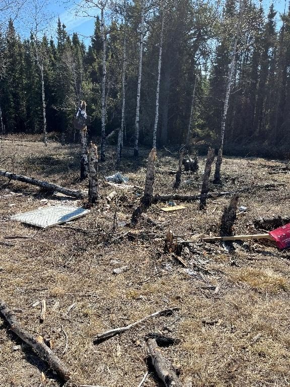
Destruction associated with target practice at Redwater River Natural Area. Photo: P Cotterill.
Astotin Natural Area, southwest of the Bruderheims, was disestablished and purchased as part of an Industrial Heartland development in 2007, a painful ending for the Fort Saskatchewan Naturalist Society after 15 years of stewardship.
North of Bruderheim Natural Area was established in 1963 on typical dune land due south across the North Saskatchewan River from Redwater Natural Area and close to where the Redwater River empties into it. It was converted to a provincial recreation area in 2012, and now occupies over 442 hectares of land given over entirely to ATV use. The government’s rationale was that such a re-designation would allow greater control through regulation. No naturalist sets foot in it now; walking is almost impossible in the rutted open sand of the trails and the sight of the deeply gouged banks of Beaverhill Creek where ATVers cross is a particular form of torture!
Better News: Natural Areas that Have Kept their Status
Several natural areas within the “arc” have, however, retained enough unspoilt habitat to be of interest to naturalists and hikers. Prospective visitors to these sites are advised to first check the appropriate page on the SAPAA website for basic information. (Go to Protected Areas – List of Protected Areas and scroll down.)
Be sure to check for any iNaturalist records that are listed for that site. This will give suggestions on what to look out for in terms of plants and animals, and possibly encourage you to add your own observations after a visit. As well, the iNaturalist map showing the boundary of the natural area and the pin-drop records provide a useful geographic orientation and outlines of the trails. Using the website invitation, you also have an opportunity to submit an “inspection report” of your visit if you wish.
Northwest of Bruderheim Natural Area
Legally established in 2007 but faithfully monitored and stewarded by former SAPAA President Hubert Taube since 1989, this is one of the closer natural areas to Edmonton and consists of two half-sections (259 hectares). It was formerly joined by a quarter-section which was later taken out of reservation although it has not since been developed. The natural area has an industrial footprint and its proximity to urban areas is probably the reason it has been rather heavily disturbed by ATV riders who exploit the pre-existing rights-of-way for powerlines, pipelines and oil and gas installations as well as old horse trails. To this can be added disturbance from occasional timber-harvesting and camping.
Nevertheless, the site remains a home to native vegetation and wildlife and in June 2024 it hosted a bioblitz. Nature specialists including birders, botanists and entomologists (studying ants, bees, beetles and butterflies) shared observations and expertise and recorded species. Biodiversity is high, with deciduous aspen stands as well as jackpine on the sandy uplands and dense treed fens with black spruce and peat mosses, and open marshes, in the hollows.
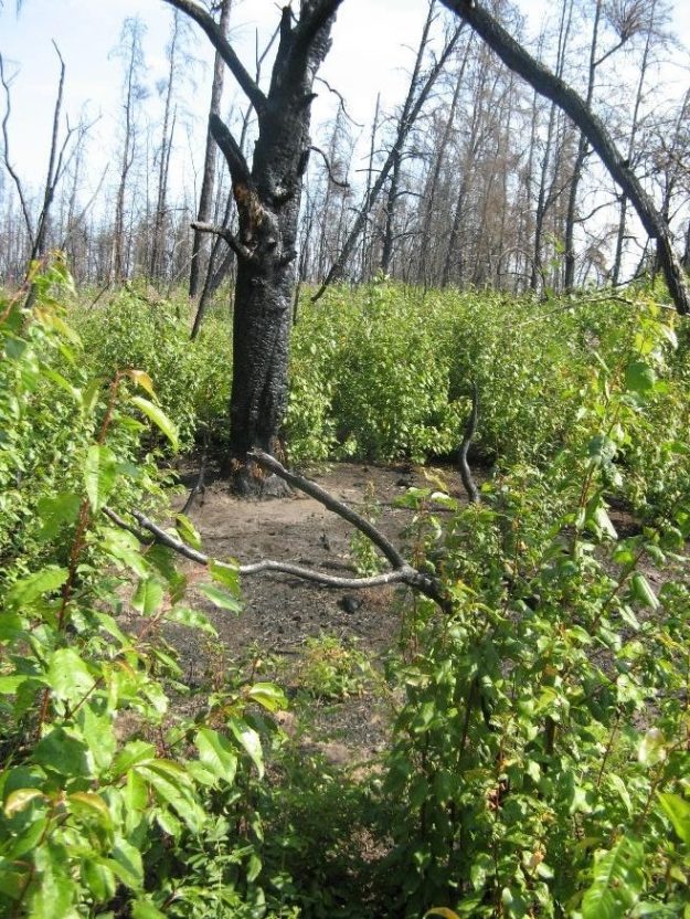
A fire that went through the area in 2009 provided a good opportunity to observe plant succession and changes in vegetation composition in the years following the burn. Seedling jack pines sprung up in the footprints of their dead, blackened parents, and the suckering pin-cherry, a shrub that likes well-drained soils, temporarily became a dominant ground cover.
A rather rare sedge that is associated with fire, Carex houghtoniana, also became temporarily abundant. Fire is an important means of natural regeneration in these dry forests, and provides opportunities for early successional or open habitat species to thrive. Without human interference many sites will return to their original mature condition or some version of it after a burn. Jack pine seeds readily germinate in the now nutrient-rich soil provided moisture conditions are right.
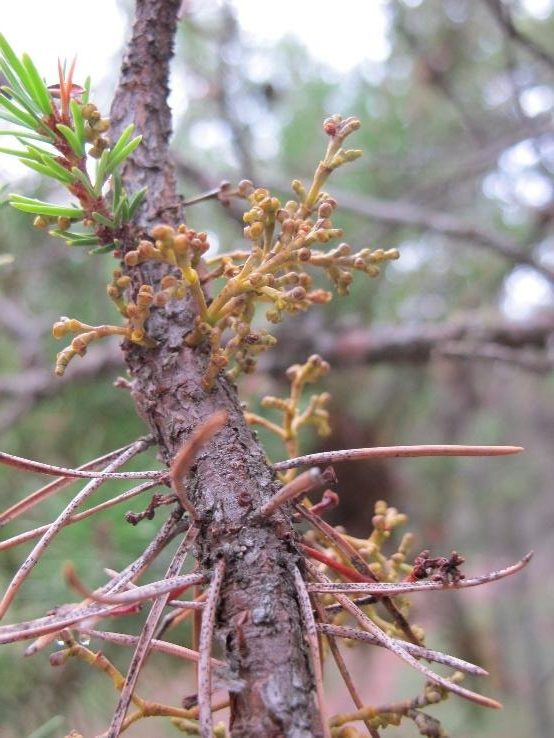
As in other sites, surviving elderly jack pine trees in Northwest of Bruderheim demonstrate infection with witch’s broom, an unnatural proliferation of branches caused by the parasitic plant dwarf mistletoe.
Opal Natural Area
This site consists of two parcels of land, one east and one west, for a total of 371 hectares, both west of the hamlet of Opal, and with differing protective status (OC and PNT portions, see the SAPAA webpage), although the actual extent of natural sandy terrain is much larger.
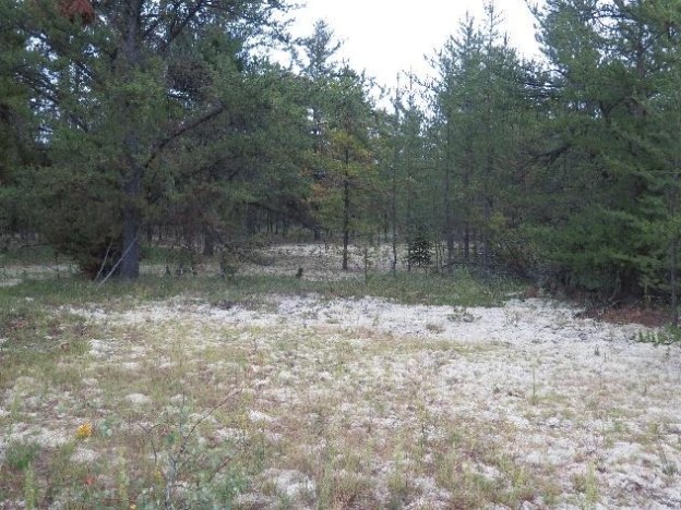
The eastern portion is the easier segment to access from the road, and is the only site listed on the Alberta government’s Parks Information and Facilities website. A fire went through part of the area a decade and a half ago, resulting in dense patches of jack pine abutting areas of relatively open sand that are being colonized with copious amounts of field wormwood, junegrass, bearded wheatgrass, northern ricegrass and sticky goldenrod among other herbaceous pioneers. A gently undulating, northwest-trending trail, ill-defined at first, passes through low-lying areas of swamps and denser forest as well as upland ridges.
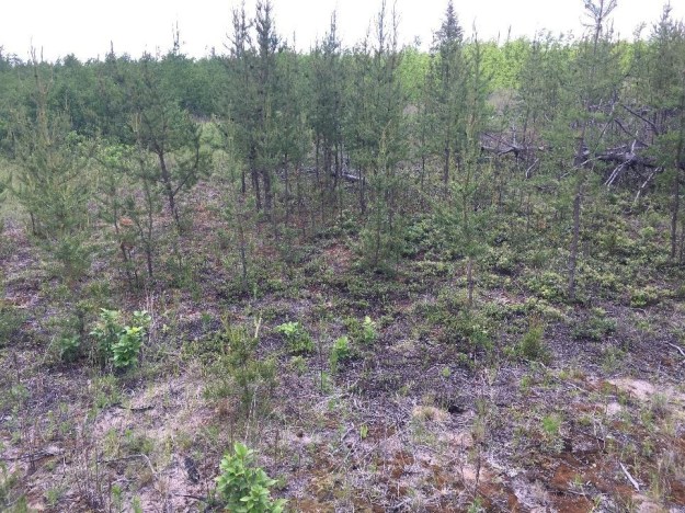
An area denuded by fire more than a decade ago regenerating with jack pine, deciduous shrubs, herbs and moss on a sandy plateau in Opal Natural Area (OC,East). The deciduous forest in the background is in a lowland area.
Describing a nature walk in Opal on July 9, 1993 in the Edmonton Journal, well-known Edmonton naturalists Joy and Cam Finlay recorded seeing 17 species of butterfly, one species better than insect guru John Acorn had seen on the previous day! More recent records, logged in iNaturalist, show the Natural Area continues to be a great site for insect life.
The area showed no signs of ATV tracks during visits to the site in June and August 2022, courtesy, apparently, of the Peaskie Mineral Inc. operation to the northeast which restricts access to ATVs. Non-native (weedy) vegetation is often refreshingly absent from many of these dune fields, as weeds require moister, more fertile soils, but at one spot along the trail a berm had been constructed. Significantly, the disturbance was associated with a patch of the invasive grass, smooth brome. Monitoring to see if it is encroaching further and if so, removing it, might make a good citizen science project!
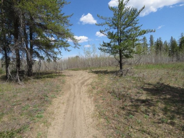
Opal West, located west of the eastern segments, is contiguous by natural terrain but not by land ownership or trails. It requires more off-road navigation to access, but is well worth a visit. For the OC portion, an oil and gas installation site provides convenient parking for access to the trail that follows a sand ridge north.
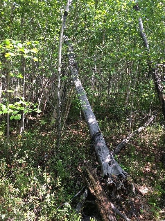
The elevation affords excellent views of expansive valleys on either side that are heavily forested with deciduous trees and give the visitor a welcome reassurance that there is still some wildness left in the settled zone of Alberta. A wetland at the base of the ridge is a marked contrast in ecosystem: its flora consists of marsh reedgrass dotted with occasional paper birch, dwarf birch and balsam willow along with some ground-hugging cloudberry, all typical of poor fens verging on bogs.
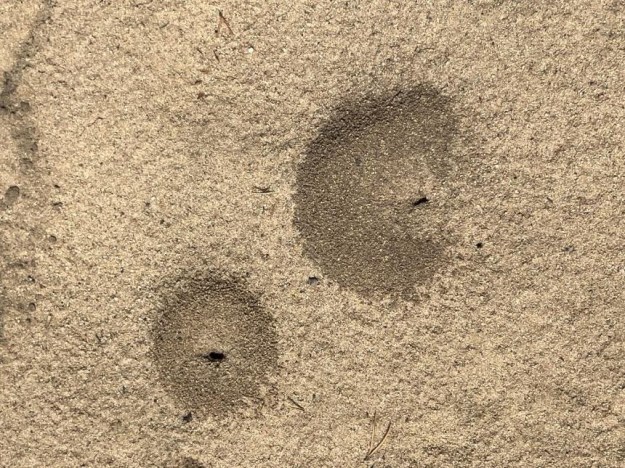
ATV tracks were present along the trail but there were no deep ruts, suggesting perhaps only light local traffic; of greater interest were the animal tracks and the abundant pit traps of antlions (family Myrmeleonidae).
The Opal area has long been popular with naturalists; it is a favourite venue of the Edmonton Nature Club for birding trips, in particular to look for owls. As shown by iNaturalist records, the summer of 2025 proved to be rewarding for naturalists who visited both the OC and PNT sections of Opal Natural Area, resulting in observations of grasshoppers, butterflies and moths as well as plants and fungi. (Note that the iNaturalist lists are separate for the OC and PN portions, but clicking on the OC or PNT web page in SAPAA’s Protected Areas list opens an identical page for Opal Natural Area as a whole.)
A second article in a subsequent newsletter will highlight a few more popular natural areas in the cluster north of Edmonton.
Reference
- Natural Resources Canada. January 2001. Sand Dune and Climate Change Studies in the Prairie Provinces. Geological Survey of Canada, Ottawa.
- SAPAA website pages for Northwest of Bruderheim and Opal Natural Areas.
- Redwater Provincial Recreation Area: https://www.albertaparks.ca/parks/central/redwater-pra/
