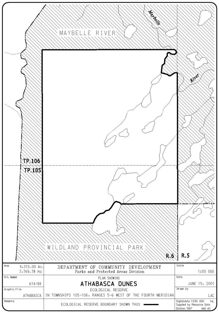
Athabasca Dunes, about 160 km north of Ft. McMurray, is the province’s largest Ecological Reserve. It contains part of Alberta’s largest active sand dune system, which is slowly migrating southeast.
- Map of the Area
- Other Information
- Biophysical Observations (via iNaturalist.ca)
- Site Statistics
- References
- Further Reading
- Site Inspections
Map of the Area
Any maps and map views are for general information only. Do not rely on them for navigation or to determine legal boundaries.
Other Information
The reserve was created in the late 1980s as part of the Wildlife ’87 project [1] and is the province’s largest Ecological Reserve. It contains part of Alberta’s largest active sand dune system stretching approximately 8 km from north to south and 1.5 km wide.
The active dunes are a series of sand ridges. They are slowly migrating southeast, burying jack pine forests and filling small lakes. There are large areas of kame and kettle. The kames, over 60 metres high, are among the largest in the world. Peatlands range from relatively dry bogs dominated by jack pine, black spruce, Labrador tea and reindeer lichen to wetter peatlands with black spruce, tamarack and peat moss. Shoreline areas include mixed forests of aspen, balsam poplar and white spruce.
Arctic terns, not known to nest elsewhere in Alberta, nest in the reserve. Total wildlife species and populations are not extensive, as a result of the lack of habitat diversity; Red Squirrels are very common, and Beaver, Muskrat, Black Bear, Red Fox, Lynx, Wolf, Moose and Mink are known to frequent the area.
WHERE DID THE SAND COME FROM? The dunes are approximately 8,000 years old and their origin can be traced back to the last ice age and the granite, gneiss, and sandstone bedrocks. The glaciers eroded these rocks on their advance and then torrents of water solidified the fields upon the glaciers’ retreat. As the lakes drained, the sands dried and accumulated into the present dunes. The dunes advance about 1.5 m each year. Any vegetation that stabilizes the sand is often destroyed in the all-too- common wildfires in the area. It is speculated that the dunes will only advance as far as the Maybelle River [2].
WHAT IS A KAME OR KETTLE? Kame and kettle topography are typically found together. Kames are mounds where till is deposited and kettles are depressions formed by ice being trapped under till and then melting. Together, they form a hump and depression landscape often containing many lakes [3].
Political Hay in 1987. 1987 was the designated Year of Wildlife Conservation in Canada by provincial and territorial wildlife ministers and their agencies. In Alberta, Wildlife ’87: Gaining Momentum was spearheaded by Cam Finlay, a well-known Alberta naturalist. More than a dozen new Natural Areas and several Ecological Reserves were designated during this period [4].
Biophysical Observations (via iNaturalist.ca)
Are you a member of iNaturalist.ca? It is free to join and you can help nature by making observations with your smart phone.
If there are no or only a few observations, how about visiting and adding some? While there, complete a site inspection report (but read the Site Inspections terms and conditions first).
Observations & Projects for this Natural Area
- Observations for this Natural Area.
- https://inaturalist.ca/projects/athabasca-dunes-ecological-reserve.
Site Statistics
| Site Name | Athabasca Dunes (ER) |
| Site Type | Ecological Reserve |
| Subtype | Order-in-council (OC) |
| Natural Region(s) | Athabasca Plain |
| O.C. No. (Land Ref. Manual) | 614/88 |
| PASite ID (Map Ref #) | 399 |
| Site # (Parks Website) | 9315.13 |
| Total Area | 3769.78 ha. (9315.13 ac.) |
| Steward-Status | |
| Recreation Activities | Birding, Hiking – backcountry, Wildlife viewing |
| IUCN | IA |
| Operated By | Parks Division |
| Notes and Comments |
References
The following links are provided as a courtesy but are not verified or endorsed by SAPAA. Clicking on the link will cause you to leave the SAPAA website. Primary source of information is: Government of Alberta – Information & Facilities – Athabasca Dunes Ecological Area | Alberta Parks. All websites accessed 2025-10-10 unless otherwise indicated.
- History of Natural Areas and Ecological Reserves 1977-1994, SAPAA Newsletter #41, January 2022.
- Mussieux, Ron, and Marilyn Nelson. A Traveller’s Guide to Geological Wonders in Alberta. Repr. Edmonton: Provincial Museum of Alberta, 2005, pp. 58-59.
- Kame et kettle – en – Géologie Québec (gouv.qc.ca)
- History of Natural Areas and Ecological Reserves 1977-1994, SAPAA Newsletter No. 41 January 2022 pp. 3-4.
Further Reading
- Sand Dunes of Alberta: Amazing Ecological Areas in Alberta, Canada – YouTube.
- Science Spotlight: Aeolian Sand Dunes — Edmonton & Area Land Trust (ealt.ca).
- Maybelle River Wildland Provincial Park and Athabasca Dunes Ecological Reserve: a synthesis of biophysical information – Open Government (alberta.ca).
Site Inspections
- No Site Inspections to date.

When you think sand dunes, maybe the Saraha comes to mind. Alberta has its own dunes and they are on the move. Another amazing corner of the province to explore!
LikeLike