This PNT covers several parcels of land on the Red Deer River north of Sundre, just upstream of the confluence with the James River.
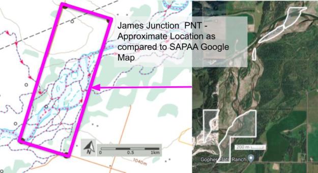
Map of the Area
Any maps and map views are for general information only. Do not rely on them for navigation or to determine legal boundaries.
Biophysical Observations (via iNaturalist)
Are you a member of iNaturalist.ca? It is free to join and you can help nature by making observations with your smart phone.
If there are no or only a few observations, how about visiting and adding some? While there, complete a site inspection report (but read the Site Inspections terms and conditions first).
Observations & Projects for this Natural Area
- Observations for this Natural Area.
- No iNaturalist Projects.
Other Information
This PNT is scattered across five distinct parcels of land. The northernmost two are adjoined. The southernmost two are across from each other and separated by the Red Deer River. A very small central site is isolated from the other two. The intervening land between these sites is privately held [1].
James River flows into the Red Deer a few kilometres downstream from this PNT. The river was named for James Dickson, a Stony chief who was a signatory to Treaty 7 in 1877. James Pass, James Lake and possibly James Creek are also named after Dickson [2]. Highway 22 crosses James River at the unincorporated community of James River Bridge [3].
Site Statistics
| Site Name | James Junction (PNT) |
| Site Type | Natural Area |
| Subtype | Protective Notation (PNT) |
| Natural Region(s) | Dry Mixedwood |
| O.C. No. (Land Ref. Manual) | N/A |
| PASite ID (Map Ref #) | 247 |
| Site # (Parks Website) | N/A |
| Total Area | 30.82 ha. (76.16 ac.) |
| Steward-Status | |
| Recreation Activities | |
| IUCN | |
| Operated By | |
| Notes and Comments |
References
The following links are provided as a courtesy but are not verified or endorsed by SAPAA. Clicking on the link will cause you to leave the SAPAA website. Primary source of information is: Government of Alberta (reviewed 2026-02-04).
- Mountain View County, Ownership Map
- Aubrey, Merrily K., ed. Concise Place Names of Alberta. Calgary: University of Calgary Press, 2006, p. 164.
- Wikipedia, James River (Alberta)
