Magee Lake NA is a quarter-section (65 ha) that lies west of, but not on, Magee Lake itself. The lake was named for a settler in the area [1], and is the southernmost of the Chain Lakes system in Central Alberta.
- Map of the Area
- Other Information
- Biophysical Observations (via iNaturalist)
- Site Statistics
- References
- Further Reading
- Site Inspections

Map of the Area
Any maps and map views are for general information only. Do not rely on them for navigation or to determine legal boundaries.
Other Information
Magee Lake NA is comprised of gently rolling aspen-covered uplands with a few wetland depressions and two gullies. It provides important wildlife habitat because of its link to Chain Lakes-Parlby Creek system (Alberta Parks website, 2012).
Magee Lake is one of three Chain Lakes* which are a string of long, narrow lakes east of Ponoka. The lakes are deeply incised into the surrounding farm land, and in most places the steep banks retain their natural tree cover. Parlby Creek, which connects all of the three lakes, flows into Spotted Lake and, eventually, into Buffalo Lake, which is part of the Red Deer River basin [2]. The nearby Gadsby Lake Natural Area is also located in the Buffalo Lake watershed [3].
The parcel of land directly south of the NA is Crown Land has a grazing lease. The intervening parcels to the lakes themselves are privately owned [4, 5, 6].
[*] Not to be confused with Chain Lakes Reservoir in Southern Alberta.
Biophysical Observations (via iNaturalist)
Are you a member of iNaturalist.ca? It is free to join and you can help nature by making observations with your smart phone.
If there are no or only a few observations, how about visiting and adding some? While there, complete a site inspection report (but read the Site Inspections terms and conditions first).
Observations & Projects for this Natural Area
- Observations for this Natural Area.
- No iNaturalist Projects.
Site Statistics
| Site Name | Magee Lake |
| Site Type | Natural Area |
| Subtype | Order-in-council (OC) |
| Natural Region(s) | Central Parkland |
| O.C. No. (Land Ref. Manual) | 454/71 |
| PASite ID (Map Ref #) | 356 |
| Site # (Parks Website) | 451 |
| Total Area | 65.00 ha. (160.62 ac.) |
| Steward-Status | |
| Recreation Activities | none noted |
| IUCN | II |
| Operated By | Parks Division |
| Notes and Comments |

Neighbour to the south of the NA looks on, 2024-08-14, Magee Lake NA, P. Potter. 
ATV track heading west from RR 244 into the NA. It loops throughout the property, 2024-08-14, Magee Lake NA, P. Potter. 
Entrance to the ATV track heading west into the NA, 2024-08-14, Magee Lake NA, P. Potter. 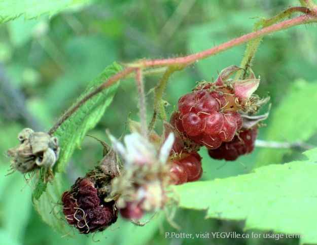
Late fruit of Red Baneberry (Actaea rubra), 2024-08-14, Magee Lake NA, P. Potter. 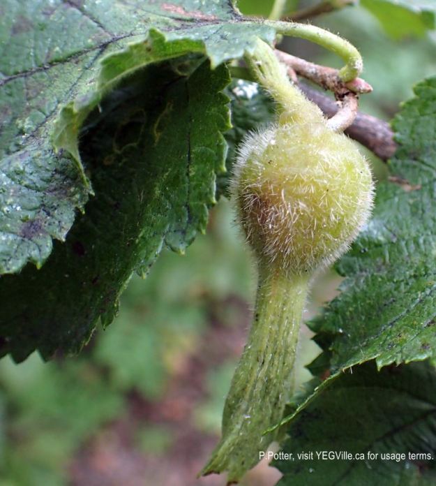
Beaked Hazelnut waiting for a nearby squirrel, 2024-08-14, Magee Lake NA, P. Potter. 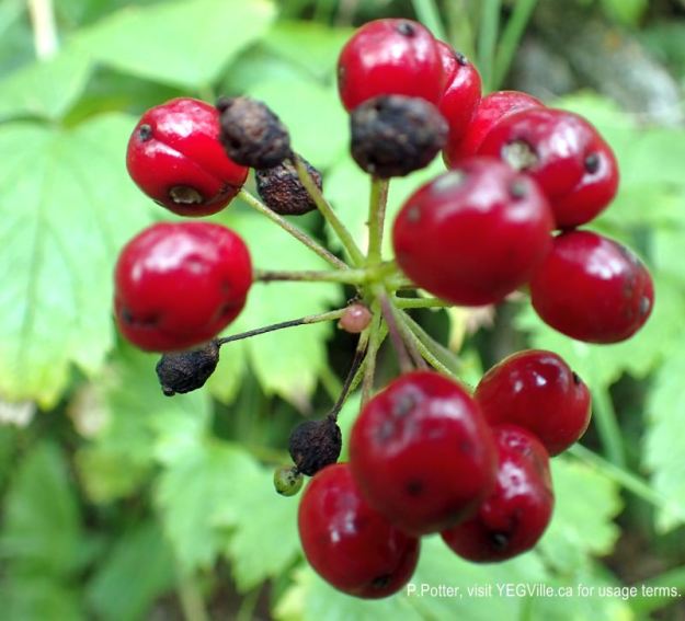
Berries almost at the end of the season, 2024-08-14, Magee Lake NA, P. Potter. 
ATV gouging in water course, 2024-08-14, Magee Lake NA, P. Potter. 
ATV track crossing a clearing and going into the mixed parkland forest, looking roughly south, 2024-08-14, Magee Lake NA, P. Potter. 
Horse’s hoof growing on a birch tree, 2024-08-14, Magee Lake NA, P. Potter. 
Like a scene from a science fiction movie, horse’s hoof erupts from a birch tree, 2024-08-14, Magee Lake NA, P. Potter. 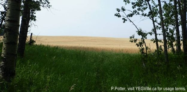
Looking roughly east from the NW corner of the NA, 2024-08-14, Magee Lake NA, P. Potter. 
Looking North from the NW corner into the two adjoining properties, 2024-08-14, Magee Lake NA, P. Potter. 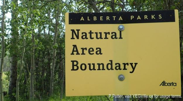
Boundary sign at the NW corner, 2024-08-14, Magee Lake NA, P. Potter. 
Turn of the ATV track, 2024-08-14, Magee Lake NA, P. Potter. ATV track, looking SE, running through a parkland, mixed forest, 2024-08-14, Magee Lake NA, P. Potter.
References
The following links are provided as a courtesy but are not verified or endorsed by SAPAA. Clicking on the link will cause you to leave the SAPAA website. Primary source of information is: Government of Alberta – Information & Facilities – Magee Lake Natural Area | Alberta Parks (2026-01-14).
- Peel Library. Geographic Board of Canada, Place-Names of Alberta (1928), p. 82 (accessed January 23, 2022).
- Chain Lakes, Alberta – Wikipedia.
- The Alberta Lake Management Society. Antler Lake Watershed Map.
- Land Ownership Maps – Lacombe County.
- Maps of Ponoka County (accessed 2026-01-14).
- Grazing lease confirmed via email with the Alberta Government, 2024-08-16.
Further Reading
- “Ponoka County : Chain Lakes Watershed Management Plan” (PDF).
- Drone footage of Magee Lake NA, Nature Central, accessed 2026-01-14.

Central Alberta is filled with recreational lakes. Sylvan, Pigeon, and Gull come to mind. Smaller, nearby lakes are just as important for wildlife habitat. They also collect run-off to recharge ground water. Magee Lake and Natural Area fall into this category.
LikeLike