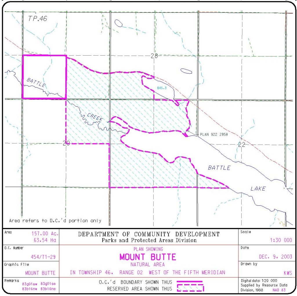
This Natural Area, located at the northwest corner of Battle Lake, consists of two adjacent portions: an OC (Order-in-Council) furthest to the northwest and a PNT (Protective Notation) portion in part hugging the shores of Battle Lake.
Map of the Area
Any maps and map views are for general information only. Do not rely on them for navigation or to determine legal boundaries.
Other Information
Mount Butte Natural Area protects more than 4 km of Battle Lake shoreline with high topographic diversity and good wildlife habitat. Vegetation includes black spruce-tamarack fen, dwarf birch-willow shrubland, sedge wetland and small areas of upland mixedwood composed of aspen and balsam poplar, birch and white spruce. (Alberta Parks website, 2012).
The two parts of the Natural Area cover some 406 ha at the western end of Battle Lake, about 15 km west of the southern tip of Pigeon Lake. Of the total area, 63 ha are protected under Order-in-Council and the rest are reserved (PNT) lands. The peak of Mt. Butte itself is in the northwest quarter of Section 21 (see map). Even though much of the area near the lake is developed, there is a great variety of plant and bird life in the Natural Area itself [1].
Biophysical Observations (via iNaturalist)
Are you a member of iNaturalist.ca? It is free to join and you can help nature by making observations with your smart phone.
If there are no or only a few observations, how about visiting and adding some? While there, complete a site inspection report (but read the Site Inspections terms and conditions first).
Observations & Projects for this Natural Area
- Mt. Butte Natural Area (OC) Observations..
- Mt. Butte (PNT) Observations.
- No iNaturalist Projects.
Site Statistics
| Site Name | Mount Butte |
| Site Type | Natural Area |
| Subtype | Order-in-council (OC) |
| Natural Region(s) | Central Mixedwood |
| O.C. No. (Land Ref. Manual) | 454/71 |
| PASite ID (Map Ref #) | 378 |
| Site # (Parks Website) | 454 |
| Total Area | 280.74 ha. (693.70 ac.) |
| Steward-Status | |
| Recreation Activities | none noted |
| IUCN | II |
| Operated By | Parks Division |
| Notes and Comments |
References
The following links are provided as a courtesy but are not verified or endorsed by SAPAA. Clicking on the link will cause you to leave the SAPAA website. Primary source of information is: Government of Alberta – Information & Facilities – Mount Butte Natural Area | Alberta Parks (2026-01-13).
- SAPAA Newsletter No. 32, September 2015, pp. 1-2.

Two NA’s for the price of one! Pigeon Lake is not often associated with mountains, but just west of the lake is Mount Butte on Battle Lake. The battle in this case refers rivalry between the Cree/Assiniboine and the Blackfoot.
LikeLike