About 30 km southeast of Nordegg, the western border of this PNT is located near the confluence of the North Ram River and Nice Creek.
- Map of the Area
- Biophysical Observations (via iNaturalist)
- Other Information
- Site Statistics
- References
- Further Reading
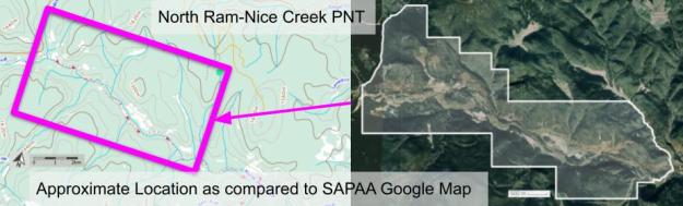
Map of the Area
Any maps and map views are for general information only. Do not rely on them for navigation or to determine legal boundaries.
Biophysical Observations (via iNaturalist)
Are you a member of iNaturalist.ca? It is free to join and you can help nature by making observations with your smart phone.
If there are no or only a few observations, how about visiting and adding some? While there, complete a site inspection report (but read the Site Inspections terms and conditions first).
Observations & Projects for this Natural Area
- Observations for this Natural Area.
- No iNaturalist Projects.
Other Information
Ram Rivulet was the original name marked on David Thompson’s map of 1814 and is likely descriptive of the Rocky Mountain Sheep found in the area [1]. A ram is a male sheep. The North Ram River flows into the Ram River which joins the North Saskatchewan River near the Town of Rocky Mountain House [2].
Site Statistics
| Site Name | North Ram-Nice Creek (PNT) |
| Site Type | Natural Area |
| Subtype | Protective Notation (PNT) |
| Natural Region(s) | Upper Foothills |
| O.C. No. (Land Ref. Manual) | N/A |
| PASite ID (Map Ref #) | 462 |
| Site # (Parks Website) | N/A |
| Total Area | 1,646.32 ha. (4,068.14 ac.) |
| Steward-Status | |
| Recreation Activities | |
| IUCN | |
| Operated By | |
| Notes and Comments |
References
The following links are provided as a courtesy but are not verified or endorsed by SAPAA. Clicking on the link will cause you to leave the SAPAA website. Primary source of information is: Government of Alberta. (reviewed 2026-01-06)
- Aubrey, Merrily K., ed. Concise Place Names of Alberta. Calgary: University of Calgary Press, 2006, p. 269.
- Wikipedia, Ram River
