The large badlands valley along Paint Earth Creek, connected to the Battle River valley, contains Paint Earth Coulee Natural Area with a PNT designation.
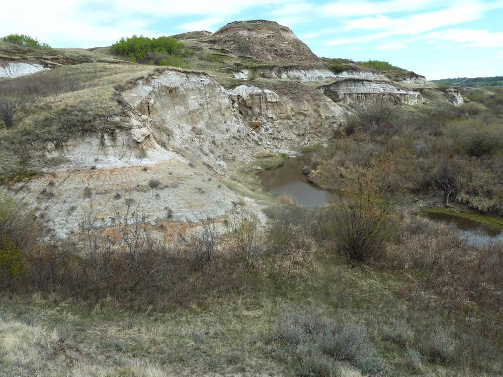
Paintearth Coulee NA includes badlands formations within the coulee, shrubby riparian vegetation along the creek, which is a tributary of the Battle River, and grasslands with a prairie flora. Grazing by cattle also occurs in the coulee.
Map of the Area
Any maps and map views are for general information only. Do not rely on them for navigation or to determine legal boundaries.
Biophysical Observations (via iNaturalist)
Are you a member of iNaturalist.ca? It is free to join and you can help nature by making observations with your smart phone.
If there are no or only a few observations, how about visiting and adding some? While there, complete a site inspection report (but read the Site Inspections terms and conditions first).
Observations & Projects for this Natural Area
- Observations for this Natural Area.
- No iNaturalist Projects.
Other Information
This large badlands valley along Paint Earth Creek contains Paint Earth Coulee Natural Area. In 2016, it was without a steward. Despite its size, there is no obvious public access to this beautiful area, as it is largely fenced off for cattle grazing. On the plus side, the current management regime does seem to be beneficial to the diverse and very natural badland flora. Nearby Big Knife Provincial Park no doubt offers similar botanical and wildlife experiences [1].
Paintearth County was formed in 1962 and was the amalgamation of previous Municipal Districts. It is named for Paintearth Creek [2].
Site Statistics
| Site Name | Paintearth Coulee (PNT) |
| Site Type | Natural Area |
| Subtype | Protective Notation (PNT) |
| Natural Region(s) | Central Parkland |
| O.C. No. (Land Ref. Manual) | N/A |
| PASite ID (Map Ref #) | 397 |
| Site # (Parks Website) | |
| Total Area | 520.11 ha. (1285.23 ac.) |
| Steward-Status | |
| Recreation Activities | |
| IUCN | |
| Operated By | |
| Notes and Comments |
References
The following links are provided as a courtesy but are not verified or endorsed by SAPAA. Clicking on the link will cause you to leave the SAPAA website. Primary source of information is: Government of Alberta.
- Paint Earth Coulee NA, Paintearth County, SAPAA Newsletter #33, May 2016, p.3.
- Aubrey, Merrily K., ed. Concise Place Names of Alberta. Calgary: University of Calgary Press, 2006.
Further Reading
- North Saskatchewan Watershed Alliance, State of the Watershed Report. (Accessed 2026-01-05)

Alberta was previously the bottom of an inland sea. The water made various deposits and it is water that slowly erodes and exposes them in time – such as here at Paintearth Coulee. Bands of eons inter-mixed with the badland terrain.
LikeLike