Located about 30 km northwest of Onoway, this Natural Area has two portions. The northern part is adjacent to the Pembina River and the southern part is north of the western arm of Majeau Lake.

- Map of the Area
- Other Information
- Biophysical Observations (via iNaturalist)
- Site Statistics
- References
- Further Reading
Map of the Area
Any maps and map views are for general information only. Do not rely on them for navigation or to determine legal boundaries.
Other Information
The north portion of this site is a narrow stretch of land along a bank of the Pembina River. The banks are steep and actively eroding. Vegetation is primarily dense shrub, second-growth aspen and sedge wetland. The south portion has dense second-growth aspen. The south portion adjoins Majeau Lake Natural Area‘s PNT portion. The intervening land between the north and southern portions is privately owned [1].
A Berry Nice River. Pembina River’s name was first recorded in 1810 by David Thompson and was thought to be a version of the Cree name meaning ‘summer berry’ [2]. It derives from the Canadian French ‘pembine’, in turn from the Cree ni-pimina-na, with the ‘min’ part meaning ‘berry’. It refers to the highbush cranberry shrub, Viburnum opulus var. americanum [3].
The river originates at Pembina Forks, about 65 km south of Edson. It flows easterly and northerly for 547 km before it merges with the Athabasca River 64 km west of the town of Athabasca [4].
Biophysical Observations (via iNaturalist)
Are you a member of iNaturalist.ca? It is free to join and you can help nature by making observations with your smart phone.
If there are no or only a few observations, how about visiting and adding some? While there, complete a site inspection report (but read the Site Inspections terms and conditions first).
Observations & Projects for this Natural Area
- Observations for this Natural Area.
- Majeau Lake Complex Observations (adjoining Pembina River).
- No iNaturalist Projects.
Site Statistics
| Site Name | Pembina River |
| Site Type | Natural Area |
| Subtype | Order-in-council (OC) |
| Natural Region(s) | Dry Mixedwood |
| O.C. No. (Land Ref. Manual) | 454/71 |
| PASite ID (Map Ref #) | 386 |
| Site # (Parks Website) | 560 |
| Total Area | 75.45 ha. (186.44 ac.) |
| Steward-Status | |
| Recreation Activities | none noted |
| IUCN | II |
| Operated By | Parks Division |
| Notes and Comments |

References
The following links are provided as a courtesy but are not verified or endorsed by SAPAA. Clicking on the link will cause you to leave the SAPAA website. Primary source of information is: Information & Facilities – Pembina River Natural Area | Alberta Parks (All links accessed on 2026-02-04).
- Lac Ste. Anne County, Map 2021.
- Aubrey, Merrily K., ed. Concise Place Names of Alberta. Calgary: University of Calgary Press, 2006, p. 249.
- https://www.dictionary.com/browse/pembina
- Wikipedia, Pembina River.
Further Reading

Amanita Mushrooms, Pembina River NA (South), 2025-07-03, P. Potter. 
Stand of birch trees near a wet area on the East side of the site, Pembina River (South), 2025-07-04, P. Potter. 
Thick forest ground cover of the site, looking East, Pembina River (South), 2025-07-04, P. Potter. 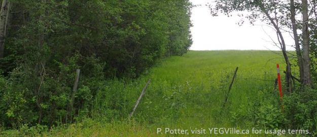
Looking South along the West border of the site from TWP 573, Pembina River (South), 2025-07-04, P. Potter. 
Wet area in the NE corner of the site, Pembina River (South), 2025-07-04, P. Potter. 
Looking South along the East border of the site (on the right), Pembina River (South), 2025-07-04, P. Potter. 
Posted sign on the adjoining property, Pembina River (South), 2025-07-04, P. Potter.
