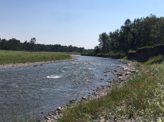
Sheep Creek NA, located 8 km northeast of Black Diamond, is a small gravel depositional area of the Sheep River channel, supporting riverine successional communities.
- Map of the Area
- Other Information
- Biophysical Observations (via iNaturalist)
- Site Statistics
- References
- Site Visits and Inspections
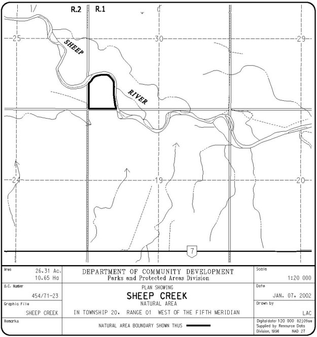
Map of the Area
Any maps and map views are for general information only. Do not rely on them for navigation or to determine legal boundaries.
Other Information
This site is in a small gravel depositional area of the Sheep River channel. It supports riverine successional communities ranging from bare gravel through a willow zone to a young balsam poplar forest.
Biophysical Observations (via iNaturalist)
Are you a member of iNaturalist.ca? It is free to join and you can help nature by making observations with your smart phone.
If there are no or only a few observations, how about visiting and adding some? While there, complete a site inspection report (but read the Site Inspections terms and conditions first).
Observations & Projects for this Natural Area
- Observations for this Natural Area.
- No iNaturalist Projects.
Site Statistics
| Site Name | Sheep Creek |
| Site Type | Natural Area |
| Subtype | Order-in-council (OC) |
| Natural Region(s) | Foothills Parkland |
| O.C. No. (Land Ref. Manual) | 454/71 |
| PASite ID (Map Ref #) | 368 |
| Site # (Parks Website) | 516 |
| Total Area | 10.65 ha. (26.31 ac.) |
| Steward-Status | |
| Recreation Activities | none noted |
| IUCN | II |
| Operated By | Parks Division |
| Notes and Comments |
References
The following links are provided as a courtesy but are not verified or endorsed by SAPAA. Clicking on the link will cause you to leave the SAPAA website. Primary source of information is: Information & Facilities – Sheep Creek Natural Area | Alberta Parks (All links accessed on 2025-04-30).

Sheep Creek is south of Calgary and north of the iconic village of Long View. A place to see where mountain transforms into prairie!
LikeLike