This PNT Natural Area is located about 15 km south of the town of Smoky Lake just south of, but not on, the North Saskatchewan River.

Map of the Area
Any maps and map views are for general information only. Do not rely on them for navigation or to determine legal boundaries.
Other Information
A Natural Corridor. Since it is close to the North Saskatchewan River, this PNT is part of a natural connection between the west and east regions of Alberta. Of note is a 2013 Cougar observation in the PNT. The area is characterized by the presence of aspen -dominated forests with white spruce and jack pine stands, and is part of a mosaic of forest patches interspersed with agricultural fields [1].
Crown Leases are found to the west and south of the PNT [2]. A site visit in 2017 showed intrusive activity from the east (see photo gallery below) but was not readily observed in 2024.
Ukalta is a locality in Lamont County and is possibly a combination of “Ukrayina” and “Alberta” [3].
Site Statistics
| Site Name | Ukalta Dunes (PNT) |
| Site Type | Natural Area |
| Subtype | Protective Notation (PNT) |
| Natural Region(s) | Dry Mixedwood |
| O.C. No. (Land Ref. Manual) | N/A |
| PASite ID (Map Ref #) | 469 |
| Site # (Parks Website) | N/A |
| Total Area | 64.12 ha. (158.45 ac.) |
| Steward-Status | |
| Recreation Activities | |
| IUCN | |
| Operated By | |
| Notes and Comments |
References
The following links are provided as a courtesy but are not verified or endorsed by SAPAA. Clicking on the link will cause you to leave the SAPAA website. Primary source of information is the Government of Alberta (All links accessed on 2025-10-23).
- Proulx, Gilbert & Dickson, H. (2013). Photographic Record of Cougar (Puma concolor) in Ukalta Dunes Natural Area, East-central Alberta, Canada , Alpha Wildlife Publications, Canadian Wildlife Biology & Management Journal 2, 80-82.
- Lamont County, 2022 Landownership Map.
- Wikipedia, List of Canadian Place Names of Ukrainian Origin.
- Aubrey, Merrily K., ed. Concise Place Names of Alberta. Calgary: University of Calgary Press, 2006, p. 332.
Site Inspections
Access gate in the NE corner of the NA, Ukalta Dunes (PNT) NA, 2024-08-30, P. Potter. 
Entrance Ukalta (PNT) Natural Area -2017 Alberta Special Places (L. Kershaw) 
Mature Mixed Forest Ukalta (PNT) Natural Area -2017 (L. Kershaw) 
Meadow Blazingstar with Painted Lady Butterfly Ukalta (PNT) Natural Area -2017 (L. Kershaw) 

Looking south from TWP 580 along the equivalent of RR175 which runs East of the NA, Ukalta Dunes (PNT) NA, 2024-08-30, P. Potter. 
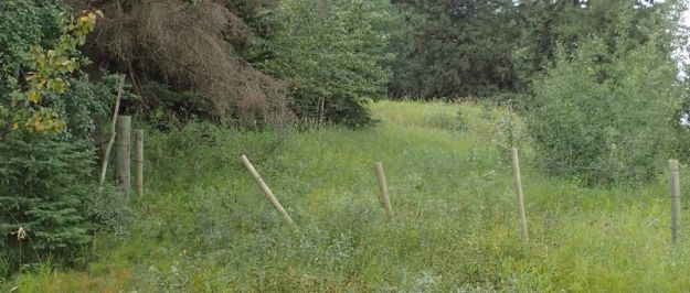
Looking south into the NA along the ATV track which runs through the east portion, Ukalta (PNT) NA, 2024-08-30, P. Potter. 
Up close and personal with a low growing ground cover, Ukalta Dunes (PNT) NA, 2024-08-30, P. Potter. 
The almost park like understory of the spruce forest on the east side of the NA, Ukalta Dunes (PNT) NA, 2024-08-30, P. Potter. 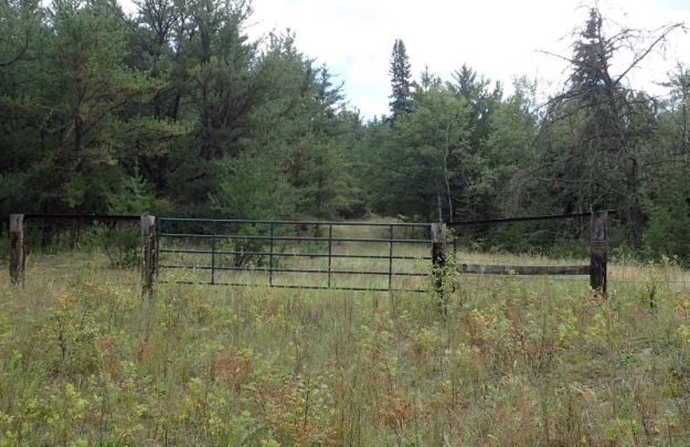
Gate in the Southeast corner of the NA and the end of the ATV track, Ukalta Dunes (PNT) NA, 2024-08-30, P. Potter. 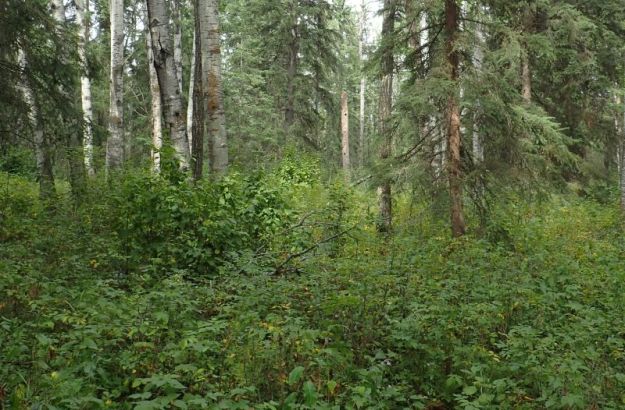
What a difference a few metres make, the understory of the mixed forest toward the middle of the NA, Ukalta Dunes (PNT) NA, 2024-08-30, P. Potter.
