Upper Mann Lake Natural Area, about 20 km northwest of St. Paul, protects a variety of riparian habitats on the islands and peninsulas of Upper Mann Lake. The lake has been shrinking and drying up in recent decades.
Map of the Area
Any maps and map views are for general information only. Do not rely on them for navigation or to determine legal boundaries.
Other Information
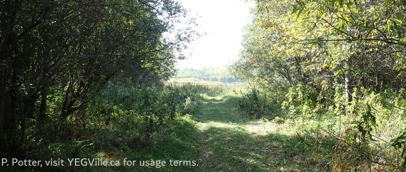
This NA protects a variety of riparian habitats on the islands and peninsulas of Upper Mann Lake. It consists of moderately to strongly rolling till substrate and cobble and sand beaches. Besides aquatic vegetation and emergents such as cattails and bulrushes, the vegetation includes willow shrublands in low-lying areas and along the lakeshore along with reedgrass meadows. On higher ground there is mixedwood forest of aspen, balsam poplar, birch and white spruce, aspen stands with diverse shrubs, and mixed shrublands. The site also features an unusual abundance of mature birch.
Upper and Lower Mann Lakes are shallow lakes set in rolling, wooded country. The lakes were named after Sir Donald Mann (1853-1934), a vice-president of the Canadian Northern Railway Company, which built a rail line close to Upper Mann Lake in the early 1900s. Before the advent of the railway, the lakes were collectively called Island Lake because they became one large lake with a central island when the water level was high [1].
Irregularly-Shaped Upper Mann Lake has numerous bays and islands. The lake is moderately developed on the north and west shore, but further development is precluded by the presence of the Upper Mann Lake Natural Area [2].

Biophysical Observations (via iNaturalist)
Are you a member of iNaturalist.ca? It is free to join and you can help nature by making observations with your smart phone.
If there are no or only a few observations, how about visiting and adding some? While there, complete a site inspection report (but read the Site Inspections terms and conditions first).
Observations & Projects for this Natural Area
- Observations for this Natural Area.
- No iNaturalist Projects.
Site Statistics
| Site Name | Upper Mann Lake |
| Site Type | Natural Area |
| Subtype | Order-in-council (OC) |
| Natural Region(s) | Central Mixedwood |
| O.C. No. (Land Ref. Manual) | 519/95 |
| PASite ID (Map Ref #) | 176 |
| Site # (Parks Website) | 490 |
| Total Area | 130.72 ha. (323.01 ac.) |
| Steward-Status | |
| Recreation Activities | none noted |
| IUCN | II |
| Operated By | Parks Division |
| Notes and Comments |

References
The following links are provided as a courtesy but are not verified or endorsed by SAPAA. Clicking on the link will cause you to leave the SAPAA website. Primary source of information is: Information & Facilities – Upper Mann Lake Natural Area | Alberta Parks (All links accessed on 2025-10-23).
- Mitchell, Patricia, and E. E. Prepas. “Atlas of Alberta Lakes.” Edmonton, Alberta: University of Alberta Press, 1990, p. 261.
- Alberta Lake Management Society, Upper Mann Lake Report 2021.
