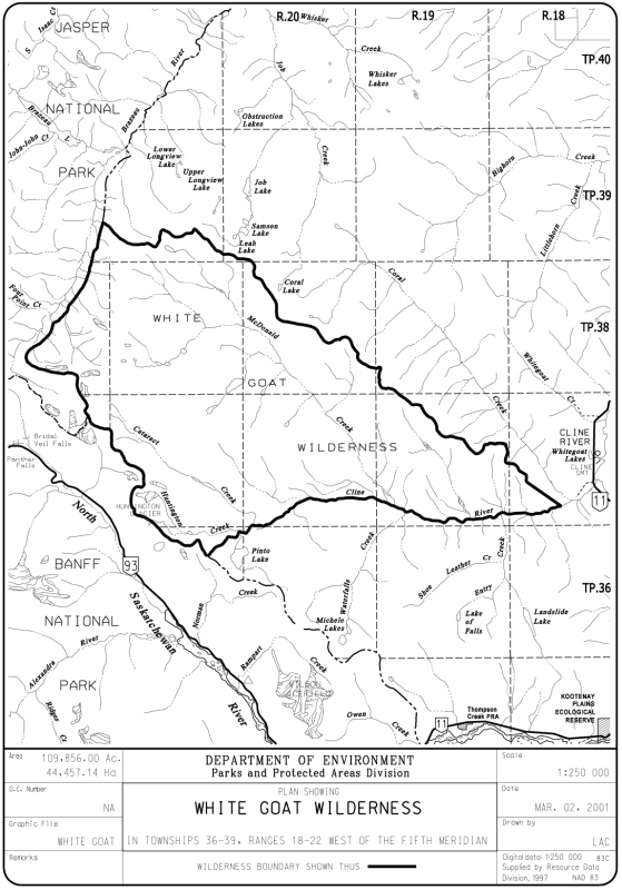
The White Goat Wilderness Area adjoins both Banff and Jasper National Parks. When it was established in 1961, it protected an area of 1,266.11 km². However, in 1973, under the Wilderness Areas Amendment Act, the Park was reduced in size by 65 percent, to 445 km² [1].
- Map of the Area
- Other Information
- Biophysical Observations (via iNaturalist)
- Site Statistics
- References
- Further Reading
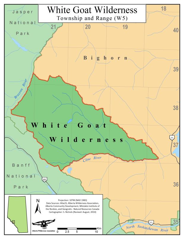
Map of the Area
Any maps and map views are for general information only. Do not rely on them for navigation or to determine legal boundaries.
Other Information
This WA contains spectacular peaks reaching over 3300 m in elevation (to 3312 m) with permanent snowfields and small glaciers. Above 2100 m, vegetation is alpine, consisting of grasses, sedges and wildflowers. Below 2100 m are forests of Engelmann and white spruce, Rocky Mountain alpine fir and lodgepole pine. Flowering season begins at lower elevations in June and finishes in the high alpine meadows in mid-July. Wildlife includes Rocky Mountain Bighorn Sheep, Mountain Goats, Woodland Caribou, Elk, Cougars, Wolves and Grizzly and Black Bears.
Foot Travel Only in White Goat Wilderness Area. Horses and mountain bikes are not permitted. Hunting and fishing are prohibited. Before visiting, inform family or friends of your intended route, camping stops and expected return time. There are no developed facilities in White Goat Wilderness Area. All litter and refuse must be packed out; human waste should be buried at least 60 metres away from any water source.
Biophysical Observations (via iNaturalist)
Are you a member of iNaturalist.ca? It is free to join and you can help nature by making observations with your smart phone.
If there are no or only a few observations, how about visiting and adding some? While there, complete a site inspection report (but read the Site Inspections terms and conditions first).
Observations & Projects for this Natural Area
- Observations for this Natural Area.
- No iNaturalist Projects.
Site Statistics
| Site Name | White Goat |
| Site Type | WA |
| Subtype | Order-in-council (OC) |
| Natural Region(s) | Alpine; Subalpine; Montane |
| O.C. No. (Land Ref. Manual) | NA |
| PASite ID (Map Ref #) | 1103 |
| Site # (Parks Website) | 397 |
| Total Area | 44457.14 ha. (109856.00 ac.) |
| Steward-Status | |
| Recreation Activities | Camping – backcountry, Hiking – backcountry |
| IUCN | IB |
| Operated By | Parks Division |
| Notes and Comments |
References
The following links are provided as a courtesy but are not verified or endorsed by SAPAA. Clicking on the link will cause you to leave the SAPAA website. Primary source of information is: Information & Facilities – White Goat Wilderness Area | Alberta Parks (All links accessed on 2023-01-17).
