Burtonsville Island Natural Area is only accessible by crossing a beaver dam, with local landowner permission, or from the river. From all accounts, it is undisturbed.
Inspection Report: 2024-09-18: Burtonsville Island (NA)
| Question | Q## | Response |
| General Information | ||
| Date/Site/Submitter: | Q21/22/12 | 2024-09-18: Burtonsville Island (NA); Phrank P. |
| Guest Names | Q14 | |
| SAPAA Member | Q16 | Yes |
| Over all Impression of the Site | ||
| What is the Naturalness of the Site? 4=Great, 0=Terrible | Q31 | Cannot Answer |
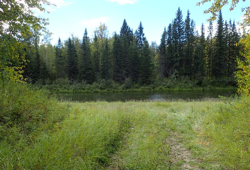
| How Natural?: comments | Q32 | A flooded channel of the North Saskatchewan River prevents access from the North to the Island. As a result, I was able to look across the channel at the NA. Reports from locals suggest that any trails that might have been in the property are being reclaimed by nature. |
| How was your visit to the PA? | ||
| Trip Duration | Q41 | Pass by but did not Go In |
| Why Did you Go? | Q42 | Other (see comments) |
| Visit Details | Q43 | As part of YEGVille.ca research, see: Burtonsville Island NA | YEGVille.ca. |
| What is in the Site? | ||
| Ease to Visit | Q51 | No Amenities |
| Biological Observations | Q52 | Not possible to visit except via a beaver dam or from the river. |
| Submissions to iNaturalist | Q53 | No, did not see anything of note |
| Geological Observations | Q54 | A very mature beaver dam has created a beautiful backwater. Downstream from the dam, the ground is saturated creating another barrier. |
| Designation as a Protected Area | Q55 | Signage |
| Comments | Q56 | A sign on the island is visible. |
| Human Activities/Disturbances | ||
| Agricultural Activities | Q61 | None noted |
| Resource extraction | Q62 | None Noted |
| Motorized disturbances (ATV or vehicle activity). | Q63 | Other (see comments, Q67) |
| Animal or self propelled activities | Q64 | None Noted |
| Gathering and Dumping Activities | Q65 | None Noted |
| Infrastructure encroachment | Q66 | None Noted |
| Comments | Q67 | A local caretaker told the story that a dozen ATVs attempted to access the island on the prior weekend. They were thwarted by the flooded river channel. |
| What Needs to be Done? | ||
| Remediation/Protection Activities Needed | Q71 | Nothing, all good, Educating Neighbours about Site Usage |
| What Have you Done Recently to Help the site? | Q72 | Visit and Submitted This Report!, Talked to nearby residents |
| Nearby Stewards? | Q73 | Border Paving is a potential steward |
| Comments | Q74 | |
| Last Words | Q82 | A great site and natural reservoir for the surrounding area. |
Images from Inspection

