Burtonsville Island Natural Area is part of a complex braided channel system of the North Saskatchewan River. St. Francis Natural Area lies across the river to the south.
- Map of the Area
- Other Information
- Biophysical Observations (via iNaturalist.ca)
- Site Statistics
- References
- Site Inspections
Map of the Area
Any maps and map views are for general information only. Do not rely on them for navigation or to determine legal boundaries.
Other Information
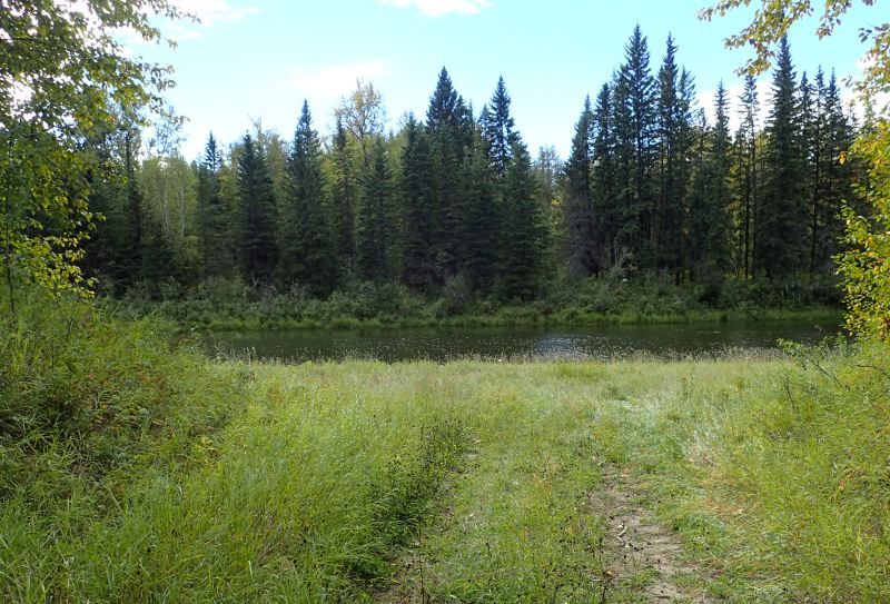
Named For the First Postmaster [1], Burtonsville Island Natural Area consists of a group of islands surrounded by a fork in the North Saskatchewan River. The vegetation includes old-growth balsam poplar and white spruce forest with a tall, dense shrub layer; mixed stands of poplar, spruce and trembling aspen with trees of varying height, density and understory composition also occur. Willow, alder and early successional communities dominate active channel banks and older inactive river channels (Alberta Parks website, 2012).
Used for Outdoor Survival Training by colleges and there are some descriptions of hiking trails [2]. An attempted site visit in September 2024 [3] suggests this information is out of date. The suggested access point requires landowner permission. A larger beaver dam has flooded the channel and made the downstream impassable. Bad for access, great for the island!

Biophysical Observations (via iNaturalist.ca)
Are you a member of iNaturalist.ca? It is free to join and you can help nature by making observations with your smart phone.
If there are no or only a few observations, how about visiting and adding some? While there, complete a site inspection report (but read the Site Inspections terms and conditions first).
Observations & Projects for this Natural Area
- Observations for this Natural Area.
- No iNaturalist Projects.
Site Statistics
| Site Name | Burtonsville Island |
| Site Type | Natural Area |
| Subtype | Order-in-council (OC) |
| Natural Region(s) | Dry Mixedwood |
| O.C. No. (Land Ref. Manual) | 531/87 |
| PASite ID (Map Ref #) | 419 |
| Site # (Parks Website) | 428 |
| Total Area | 328.00 ha. (810.49 ac.) |
| Steward-Status | |
| Recreation Activities | cross-country skiing, hunting, wildlife viewing |
| IUCN | II |
| Operated By | Parks Division |
| Notes and Comments |

References
The following links are provided as a courtesy but are not verified or endorsed by SAPAA. Clicking on the link will cause you to leave the SAPAA website. Primary source of information is: Government of Alberta – Information & Facilities – Burtonsville Island Natural Area | Alberta Parks (accessed 2025-04-09).
- Burtonsville was named for the 1912 post master of the community, Cornelius Burton. Hills of Hope road side sign: Burtonsville Community.
- Travel and Trails. Burtonsville Island Natural Area (accessed 2022 04 08).
- Burtonsville Island NA | YEG Ville (accessed 2024-09-23).

Burtonsville is on the North Saskatchewan River and close by the City of Edmonton. I writing up the pages, Google hits count against a site. In this case, Burtonsville is used for survival training. Does Skip the Dishes deliver to Burtonsville? Seriously, this is an example of a site san photo. Anyone up to the challenge and visiting and returning with a better image? (Registration for survival training on your visit is optional)
LikeLike
Can confirm, Canoe access only. Every time I’ve tried to park where you are showing, I’ve either 1) had my vehicle vandalized or have had the RCMP either wait for me or call my partner, who is registered to the car.
LikeLike
Thanks Cory, no vandalism (thankfully!) but two very nice RCMP constables waiting for me. Try knocking on the trailer of the mine site and see if the caretaker will let you in.
LikeLike