Bellis Lake (OC and PNT) and Bellis North Natural Areas are in close proximity to each other but bisected by Highway 28 and together cover an area of approx. 1,600 ha. All three are on sandy soils with a flora characteristic of this soil type.

- Map of the Area
- Other Information
- Biophysical Observations (via iNaturalist.ca)
- Site Statistics
- References, Further Reading and Links
Map of the Area
Any maps and map views are for general information only. Do not rely on them for navigation or to determine legal boundaries.
Other Information
Bellis Lake and Bellis North Natural Areas encompass a sandy vegetated dune complex dissected with several major ravines containing numerous ponds and wetlands. There is high potential for erosion due to the sandy soils. Vegetation includes predominantly jack pine on the uplands along with aspen stands; black spruce, tamarack and birch occupy the low-lying lands.
A forest fire went through Bellis North Natural Area in the spring of 2002, but approximately 40% of the site was untouched by the fire (Alberta Parks website, 2012).
Unfortunately this site appears to be well-known by operators of off-highway vehicles. A recent site inspection is not available to confirm this.
Biophysical Observations (via iNaturalist.ca)
Are you a member of iNaturalist.ca? It is free to join and you can help nature by making observations with your smart phone.
If there are no or only a few observations, how about visiting and adding some? While there, complete a site inspection report (but read the Site Inspections terms and conditions first).
Observations & Projects for this Natural Area
- Bellis Lake (OC) Observations.
- Bellis North (OC) Observations.
- Bellis Lake (PNT) Observations.
- No iNaturalist Projects.
Site Statistics
Bellis North (OC)
| Site Name | Bellis North |
| Site Type | Natural Area |
| Subtype | Order-in-council (OC) |
| Natural Region(s) | Dry Mixedwood |
| O.C. No. (Land Ref. Manual) | 519/95 |
| PASite ID (Map Ref #) | 363 |
| Site # (Parks Website) | 476 |
| Total Area | 1088.50 ha. (2689.68 ac.) |
| Steward-Status | |
| Recreation Activities | none noted |
| IUCN | II |
| Operated By | Parks Division |
| Notes and Comments |
Bellis Lake (OC)
| Site Name | Bellis Lake |
| Site Type | Natural Area |
| Subtype | Order-in-council (OC) |
| Natural Region(s) | Dry Mixedwood |
| O.C. No. (Land Ref. Manual) | 454/71 |
| PASite ID (Map Ref #) | 538 |
| Site # (Parks Website) | 475 |
| Total Area | 62.00 ha. (153.20 ac.) |
| Steward-Status | |
| Recreation Activities | none noted |
| IUCN | II |
| Operated By | Parks Division |
| Notes and Comments |
Bellis Lake (PNT)
| Site Name | Bellis Lake (PNT) |
| Site Type | Natural Area |
| Subtype | Protective Notation (PNT) |
| Natural Region(s) | Dry Mixedwood |
| O.C. No. (Land Ref. Manual) | N/A |
| PASite ID (Map Ref #) | 538 |
| Site # (Parks Website) | N/A |
| Total Area | 451.00 ha. (1114.42 ac.) |
| Steward-Status | |
| Recreation Activities | |
| IUCN | IV*6 |
| Operated By | |
| Notes and Comments |

References, Further Reading and Links
The following links are provided as a courtesy but are not verified or endorsed by SAPAA. Clicking on the link will cause you to leave the SAPAA website. Primary source of information is: Government of Alberta – Information & Facilities – Bellis Lake Natural Area | Alberta Parks, Information & Facilities – Bellis North Natural Area | Alberta Parks (2022-02-14).

Sandy slope south of access point on RR 153. 
Powerline showing grasses used in revegetation. 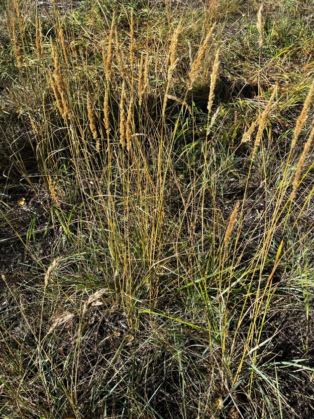
Plains reedgrass sown to revegetate the powerline. 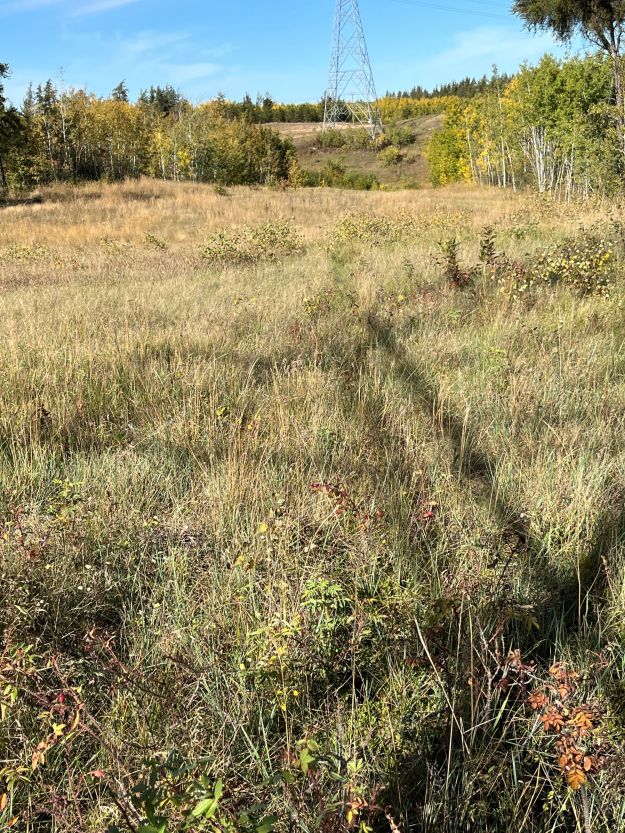
Powerline looking northeast. 
Area of open jack pine with dry aspen forest on slope in the background, 
West end of lake seen from north slope. 
Lakeshore showing one of many incised beaver channels. 
Northern pocket gopher mounds in open area near lake. 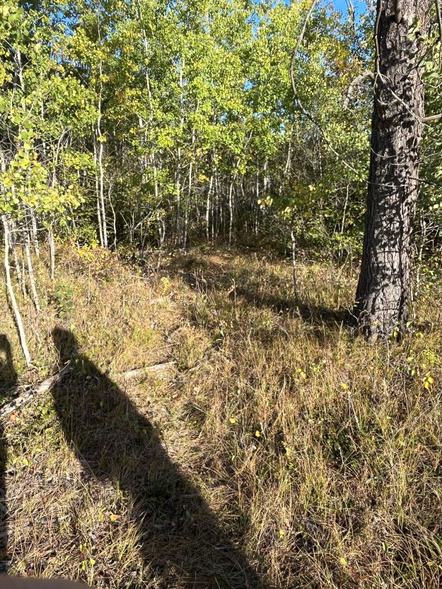
Deer trail providing quick access to the lake from the powerline.

‘Contiguous’ is a word used a lot on the SAPAA site meaning connected. For a critter living in one of these areas it also means survival. For some, there is a large food supply not protected by a local farmer or disturbed by humans. For predators, it means a sufficiently large range and a steady supply of food and potential mates. For parasites, it makes life more difficult as their potential prey is spread out further. Bellis Lake is one such contiguous area found northeast of Edmonton.
LikeLike