This irregularly shaped CNT site is located approximately 30 km west of Claresholm in the Porcupine Hills.
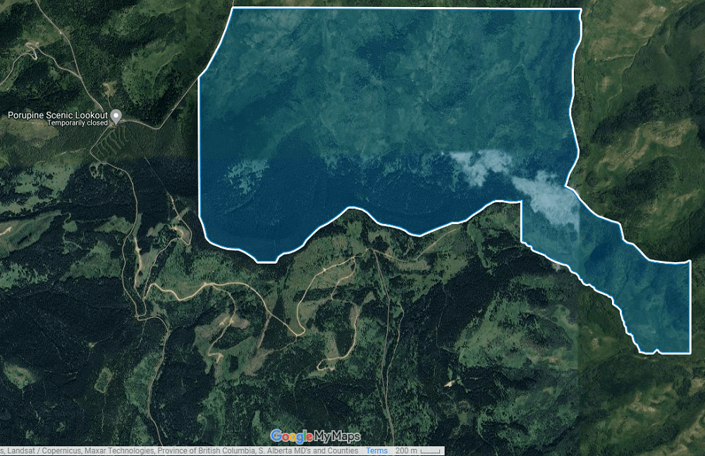
Map of the Area
Any maps and map views are for general information only. Do not rely on them for navigation or to determine legal boundaries.
Biophysical Observations (via iNaturalist)
Are you a member of iNaturalist.ca? It is free to join and you can help nature by making observations with your smart phone.
If there are no or only a few observations, how about visiting and adding some? While there, complete a site inspection report (but read the Site Inspections terms and conditions first).
Observations & Projects for this Natural Area
- Observations for this Natural Area.
- No iNaturalist Projects.
Other Information
East Porcupine Natural Area is partially located in the Porcupine Hills Public Land Use Zone (PLUZ). The PLUZ includes designated areas for motorized recreation [1].
Site Statistics
| Site Name | East Porcupine (CNT) |
| Site Type | Natural Area |
| Subtype | Consultative Notation (CNT) |
| Natural Region(s) | Montane |
| O.C. No. (Land Ref. Manual) | N/A |
| PASite ID (Map Ref #) | 417 |
| Site # (Parks Website) | N/A |
| Total Area | 833.59 ha. (2059.83 ac.) |
| Steward-Status | |
| Recreation Activities | |
| IUCN | |
| Operated By | |
| Notes and Comments |
References
The following links are provided as a courtesy but are not verified or endorsed by SAPAA. Clicking on the link will cause you to leave the SAPAA website. Primary source of information is: Government of Alberta. All websites accessed 2022-11-12.
