This densely wooded PNT is situated adjacent to the western shore of Pigeon Lake.
- Map of the Area
- Biophysical Observations (via iNaturalist)
- Other Information
- Site Statistics
- References
- Site Inspections
- Photo Gallery
Map of the Area
Any maps and map views are for general information only. Do not rely on them for navigation or to determine legal boundaries.
Biophysical Observations (via iNaturalist)
Are you a member of iNaturalist.ca? It is free to join and you can help nature by making observations with your smart phone.
If there are no or only a few observations, how about visiting and adding some? While there, complete a site inspection report (but read the Site Inspections terms and conditions first).
Observations & Projects for this Natural Area
- Observations for this Natural Area.
- No iNaturalist Projects.
Other Information
A Large Slough. Pigeon Lake is both one of Alberta’s larger freshwater lakes and also a “… large slough with residential development and recreational use.” [1]. The lake has a total area of 96.7 km2 and a maximum depth of 9.1 m. It ultimately feeds the Battle River, to which it is connected through the Pigeon Lake Creek.
Woodpecker Lake was the original name but this was changed to Pigeon Lake in 1858 due to the large number of passenger pigeons nesting in the area. In 1896, Pigeon Lake Indian Reserve was established on the southeast shore. Later, the summer village of Ma-Me-O Beach was developed at the south end of the lake on land obtained from the Indian reserve in 1924. Ma-Me-O (omîmîw) is a Cree word meaning “pigeon” [2].
A Management Plan was established in 2018 by all municipalities within the watershed and endorsed by the Chiefs of the Maskwacis Cree Four Nations, Pigeon Lake Regional Chamber of Commerce and other key stakeholders. The goal of the plan is to [3]:
- Reduce the frequency and intensity of algal blooms
- Improve the health of the watershed and lake
- Improve the recreational value of the lake and economic health of the region.
Site Statistics
| Site Name | Pigeon Lake (PNT) |
| Site Type | Natural Area |
| Subtype | Protective Notation (PNT) |
| Natural Region(s) | Central Mixedwood; Dry Mixedwood |
| O.C. No. (Land Ref. Manual) | N/A |
| PASite ID (Map Ref #) | 240 |
| Site # (Parks Website) | N/A |
| Total Area | 64.30 ha. (158.90 ac.) |
| Steward-Status | |
| Recreation Activities | |
| IUCN | |
| Operated By | |
| Notes and Comments |
References
The following links are provided as a courtesy but are not verified or endorsed by SAPAA. Clicking on the link will cause you to leave the SAPAA website. Primary source of information is the Government of Alberta (All links accessed on 2026-01-04).
- 2015 Volunteer Conference in Wetaskiwin, SAPAA Newsletter No 33 May 2016, p 2.
- Wikipedia, Pigeon Lake.
- Pigeon Lake Watershed Association, Pigeon Lake Watershed Management Plan.
Site Inspections
Photo Gallery

Approximate location of Pigeon Lake NA (red square) (Government of Alberta). 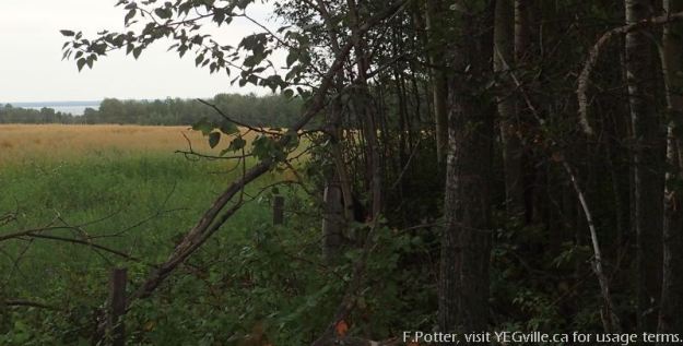
View of the lake, looking East from the Northwest corner of the Pigeon Lake NA. 
Looking south towards TWP RD 464. The Pigeon Lake NA is on the left and behind the fence. 
A weather beaten sign indicating the southern border of Pigeon Lake NA along TWP RD 464. 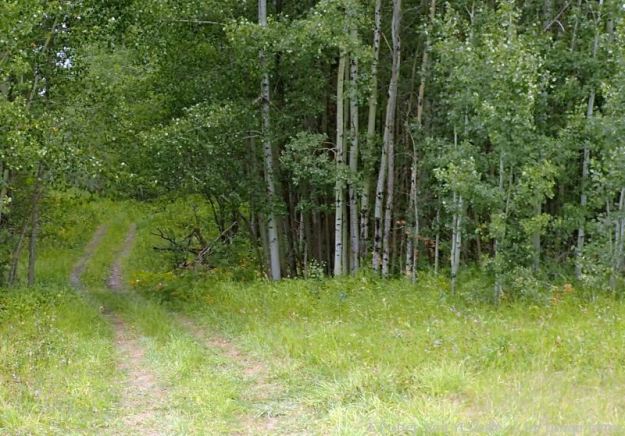
Quad track heading North into Pigeon Lake NA from TWP RD 464. 
A somewhat overgrown quad track heading North into Pigeon Lake NA from TWP RD 464; a weather beaten NA sign is seen to the right. 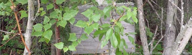
A sign post that has long since lost what was probably an indicator that this was the Pigeon Lake NA. Seen from HWY 771 near RR 14 intersection. 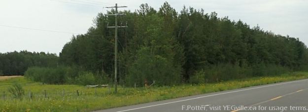
The Northeast Pigeon Lake NA ‘wedge’ can be seen clearly from highway 771, looking Southeast from HWY 771. 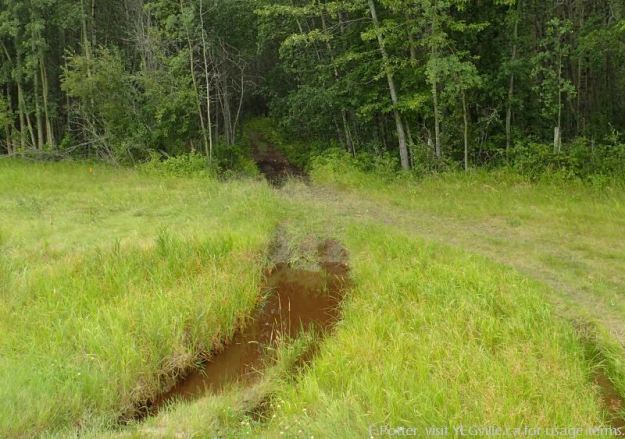
A well gouged ATV track heads west from HWY 771 into the Pigeon Lake NA.
