Riverlot 56 Natural Area provides a natural refuge on the northwest outskirts of the City of St. Albert in Sturgeon County, and is well-patronized by local residents. It allows for nature-based recreation in the form of hiking and bird- and plant-watching in all seasons, and cross-country skiing in the winter.
- Map of the Area
- Other Information
- Biophysical Observations (via iNaturalist.ca)
- Statistics
- References
- Further Reading
- Site Inspections
Map of the Area
Any maps and map views are for general information only. Do not rely on them for navigation or to determine legal boundaries.
Other Information
HISTORY [1, adapted]: Riverlot 56 is one of the original parcels of land subdivided during settlement of the region in the 1900s. It went unsold from the 1800s until purchased by the Dominion government to build a residential school on.
In 1965, the unused portion of the lot was transferred to the provincial government. At that time, the intention was to build Alberta’s third university. A change in government saw the university moved up Highway 2 to Athabasca and the lot remained vacant.
Since 1973, local groups have maintained the area for outdoor education and nature-based recreation.
ENVIRONMENT: The site lies in the Central Parkland Subregion and contains upland aspen forests, streambed and ravine communities and open meadows, which provide habitat for wildlife including White-tailed Deer, Moose, Coyote, Snowshoe Hare, Muskrat and Beaver. It abuts on the Sturgeon River on the west side. Under a municipal bylaw, hunting is prohibited in this natural area. (Alberta Parks website, 2012).
RECREATION [1, adapted]: Recreational ctivities include:
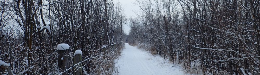
- Cross-Country Skiing: There are approximately 8 km of groomed cross-country ski trails [2].
- Snowshoeing. (Be careful to avoid the set-tracks in the above ski trails.)
- Hiking: There’s a self-guided walking trail with natural history interpretive signage.
- Geocaching Site
Biophysical Observations (via iNaturalist.ca)
Are you a member of iNaturalist.ca? It is free to join and you can help nature by making observations with your smart phone.
If there are no or only a few observations, how about visiting and adding some? While there, complete a site inspection report (but read the Site Inspections terms and conditions first).
Observations & Projects for this Natural Area
- Observations for this Natural Area.
- No iNaturalist Projects.
Statistics
| Site Name | Riverlot 56 |
| Site Type | Natural Area |
| Subtype | Order-in-council (OC) |
| Natural Region(s) | Central Parkland |
| O.C. No. (Land Ref. Manual) | 221/87 |
| PASite ID (Map Ref #) | 453 |
| Site # (Parks Website) | 416 |
| Total Area | 105.08 ha. (259.65 ac.) |
| Steward-Status | |
| Recreation Activities | Hiking – front country, Wildlife viewing; Cross-country skiing |
| IUCN | II |
| Operated By | Parks Division |
| Notes and Comments |
References
The following links are provided as a courtesy but are not verified or endorsed by SAPAA. Clicking on the link will cause you to leave the SAPAA website. Primary source of information is: Government of Alberta – Information & Facilities – Riverlot 56 Natural Area (2025-04-17).
- Riverlot 56, City of St. Albert (accessed 2022-01-08).
- Groomed cross-country ski trails in the Riverlot 56 Natural Area.
Further Reading
- Riverlot 56 Then & Now, T8N Magazine (accessed 2022-01-08).
- SAPAA Newsletter No. 39, July 2021, pp. 6-8.
- SAPAA Newsletter No. 31, March 2015, pp. 5-6.
- SAPAA Newsletter No. 29, September 2013, p. 2.
- SAPAA Newsletter No. 14, February 2006, p. 1.
- SAPAA Newsletter No. 9, September 2003, p. 4.

An unsold parcel of land purchased to build a residential school. The river portion is now a beloved recreational area for metro-Edmonton. An important oasis with the encroachment of urbanization from all sides.
LikeLike