Two non-contiguous parcels of land (one small, one large), both on the east bank of the Red Deer River, just south of the Town of Sundre, compose this NA.
- Map of the Area
- Other Information
- Biophysical Observations (via iNaturalist)
- Site Statistics
- References
- Further Reading
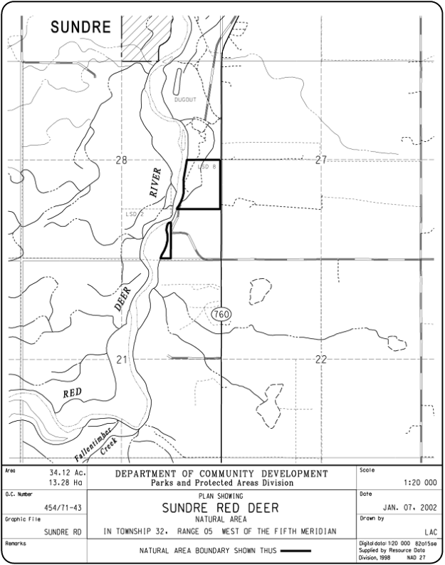
Map of the Area
Any maps and map views are for general information only. Do not rely on them for navigation or to determine legal boundaries.
Other Information
Sundre Red Deer Natural Area encompasses steep slopes and river flats along the Red Deer River. The slopes are primarily vegetated with white spruce stands.
Two non-contiguous portions make up this NA. The intervening parcel of land is also crown land [1].
Sundry Sundres. Within hiking distance from the Town of Sundre there are eight protected area sites, from upstream to downstream: Bearberry Prairie NA (OC and PNT), Sundre NA (OC and PNT), Sundre Red Deer NA, Sundre North NA and Snakes Head NA (OC and PNT).
Biophysical Observations (via iNaturalist)
Are you a member of iNaturalist.ca? It is free to join and you can help nature by making observations with your smart phone.
If there are no or only a few observations, how about visiting and adding some? While there, complete a site inspection report (but read the Site Inspections terms and conditions first).
Observations & Projects for this Natural Area
- Observations for this Natural Area.
- No iNaturalist Projects.
Site Statistics
| Site Name | Sundre Red Deer |
| Site Type | Natural Area |
| Subtype | Order-in-council (OC) |
| Natural Region(s) | Dry Mixedwood |
| O.C. No. (Land Ref. Manual) | 454/71 |
| PASite ID (Map Ref #) | 371 |
| Site # (Parks Website) | 520 |
| Total Area | 13.28 ha. (34.12 ac.) |
| Steward-Status | |
| Recreation Activities | Canoeing/kayaking |
| IUCN | II |
| Operated By | Parks Division |
| Notes and Comments |
References
The following links are provided as a courtesy but are not verified or endorsed by SAPAA. Clicking on the link will cause you to leave the SAPAA website. Primary source of information is: Information & Facilities – Sundre Red Deer Natural Area | Alberta Parks (All links accessed on 2025-05-08).
