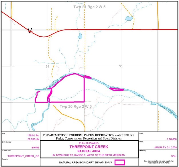
Threepoint Creek is a tributary of the Sheep River and the NA is at its confluence. The site is about 15 km west of Okotoks and is composed of four parts including two small islands in the Sheep River.

Map of the Area
Any maps and map views are for general information only. Do not rely on them for navigation or to determine legal boundaries.
Other Information
Threepoint Creek Natural Area is located at the confluence of the Sheep River and Threepoint Creek. The 2012 Government of Alberta website contained this additional reference: “…it contains a great blue heron colony.”
Confluence of the Two Waterbodies has been identified by the Alberta Government as a potential candidate area for the Fisheries Enhancement and Sustainability Program [1]. The river’s name is descriptive and a translation from the original native name. Upstream at Highwood, there is a point where the Rocky Mountain big horn sheep like to gather [2].
Biophysical Observations (via iNaturalist)
Are you a member of iNaturalist.ca? It is free to join and you can help nature by making observations with your smart phone.
If there are no or only a few observations, how about visiting and adding some? While there, complete a site inspection report (but read the Site Inspections terms and conditions first).
Observations & Projects for this Natural Area
- Observations for this Natural Area.
- No iNaturalist Projects.
Site Statistics
| Site Name | Threepoint Creek |
| Site Type | Natural Area |
| Subtype | Order-in-council (OC) |
| Natural Region(s) | Foothills Parkland |
| O.C. No. (Land Ref. Manual) | 416/98 (previous 146/85 |
| PASite ID (Map Ref #) | 476 |
| Site # (Parks Website) | 521 |
| Total Area | 52.2 ha. (129.01 ac.) |
| Steward-Status | |
| Recreation Activities | none noted |
| IUCN | II |
| Operated By | Parks Division |
| Notes and Comments |
References
The following links are provided as a courtesy but are not verified or endorsed by SAPAA. Clicking on the link will cause you to leave the SAPAA website. Primary source of information is: Information & Facilities – Threepoint Creek Natural Area | Alberta Parks (All links accessed on 2025-10-29).
- Alberta Government, Threepoint Creek Summary Report, 2018.
- P. 293. DONOVAN, LARRY. ALBERTA PLACE NAMES: The Fascinating People & Stories behind the Naming of Alberta. Canada: DRAGON HILL PUB, 2007.
Site Inspections
(On smart phones, swipe to advance the pictures)
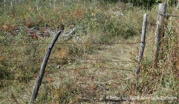
A weather worn gate at the SE corner of the NA, 2024-09-21, Threepoint Creek Na, P. Potter. 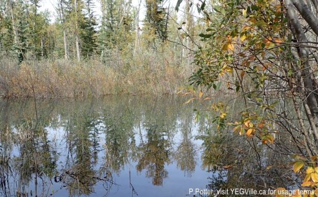
Pond created by the beavers on the creek, 2024-09-21, Threepoint Creek Na, P. Potter. 
ATV track running north from RR 22, 2024-09-21, Threepoint Creek Na, P. Potter. 
Likely local kids have created a rock dam – and then had help from the beavers, 2024-09-21, Threepoint Creek Na, P. Potter. 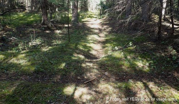
An East-West trail is in the foreground and intersects the North-South trail that leads to the Sheep River. 2024-09-21, Threepoint Creek Na, P. Potter. 
The Sheep River at the North end of the NA. 2024-09-21, Threepoint Creek Na, P. Potter. 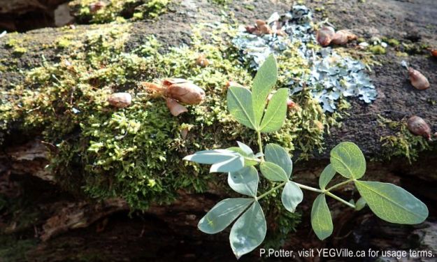
Plants and fungus colonizing a fallen tree. 2024-09-21, Threepoint Creek Na, P. Potter. 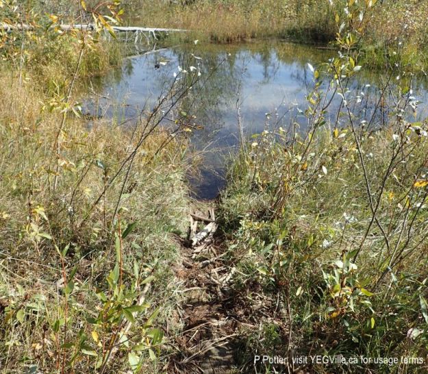
Near the dam, a beaver run to a small pond, looking East. 2024-09-21, Threepoint Creek Na, P. Potter.

The Sheep River flows through Alberta’s southern foothills. Draining the waters from the Rocky Mountains, it makes its way towards Hudson Bay. This NA watches the waters go by as the river hooks to the east. A quiet spot in a transition zone of geography.
LikeLike