Located about about 20 km southwest of Pigeon Lake, east of Highway 20, this full-section Natural Area has good wildlife habitat.

- Map of the Area
- Other Information
- Biophysical Observations (via iNaturalist)
- Site Statistics
- References
- Further Reading
Map of the Area
Any maps and map views are for general information only. Do not rely on them for navigation or to determine legal boundaries.
Other Information
Town Creek Natural Area, 10 km south of Winfield, encompasses a large black spruce fen and small creek in rolling moraine with aspen on upland and willow wetlands in depressions; it provides good wildlife habitat.
A Town Follows a Blindman. Despite its proximity to Pigeon Lake and Battle Lake, nearby Town Lake and Town Creek drain into the Red Deer River and thence into the South Saskatchewan via the Blindman River. The NA is near the height of land that separates the North and South Saskatchewan River basins [1].
Biophysical Observations (via iNaturalist)
Are you a member of iNaturalist.ca? It is free to join and you can help nature by making observations with your smart phone.
If there are no or only a few observations, how about visiting and adding some? While there, complete a site inspection report (but read the Site Inspections terms and conditions first).
Observations & Projects for this Natural Area
- Observations for this Natural Area.
- No iNaturalist Projects.
Site Statistics
| Site Name | Town Creek |
| Site Type | Natural Area |
| Subtype | Order-in-council (OC) |
| Natural Region(s) | Lower Foothills |
| O.C. No. (Land Ref. Manual) | 519/95 |
| PASite ID (Map Ref #) | 510 |
| Site # (Parks Website) | 469 |
| Total Area | 254.04 ha. (627.74 ac.) |
| Steward-Status | |
| Recreation Activities | none noted |
| IUCN | II |
| Operated By | Parks Division |
| Notes and Comments |

References
The following links are provided as a courtesy but are not verified or endorsed by SAPAA. Clicking on the link will cause you to leave the SAPAA website. Primary source of information is: Government of Alberta (Accessed on 2025-05-15).
- Analysis based on Alberta Environment and Parks, Alberta River Basins flood alerting, advisories, reporting and water management.
Site Inspections
- 2024-09-24: Town Creek (NA); Phrank P. (unpublished)
Further Reading
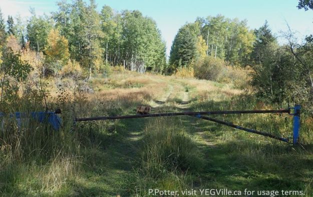
Looking East from HWY 20 into the site, note home made sled, Town Creek NA, 2024-09-25, P. Potter. 
Looking S into a small pond from the service road, Town Creek NA, 2024-09-25, P. Potter. 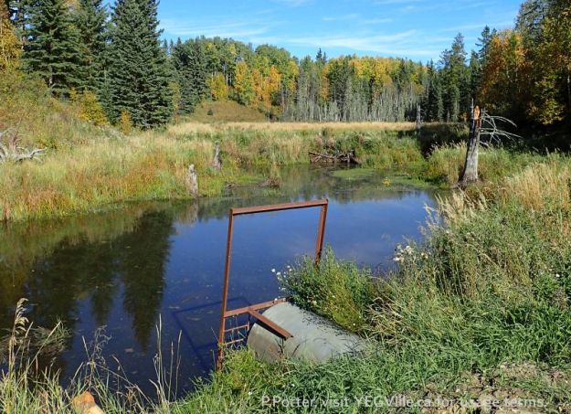
Looking NE towards a beaver dam blocking Town Creek, note the large culvert in the foreground, Town Creek NA, 2024-09-25, P. Potter. 
Fall colours and a wet area, looking E and roughly at the Eastern border, Town Creek NA, 2024-09-25, P. Potter. 
Red moss colony along the East-West cut line, Town Creek NA, 2024-09-25, P. Potter. 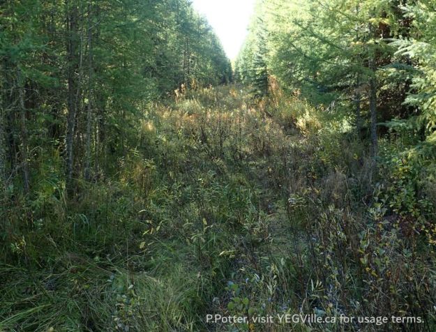
Looking W along the cut line and towards the entry gate, Town Creek NA, 2024-09-25, P. Potter.
