Composed of two sites about 30 km south of Rocky Mountain House, Chedderville NA consists of an OC portion that straddles the Clearwater River and a PNT portion that borders the river only on its northeast corner.

- Map of the Area
- Biophysical Observations (via iNaturalist.ca)
- Other Information
- Site Statistics
- References
- Further Reading
Map of the Area
Any maps and map views are for general information only. Do not rely on them for navigation or to determine legal boundaries.
Biophysical Observations (via iNaturalist.ca)
Are you a member of iNaturalist.ca? It is free to join and you can help nature by making observations with your smart phone.
If there are no or only a few observations, how about visiting and adding some? While there, complete a site inspection report (but read the Site Inspections terms and conditions first).
Observations & Projects for this Natural Area
- Chedderville (OC) Observations.
- Chedderville (PNT) Observations.
- No iNaturalist Projects.
Other Information
This site consists of the braided flats of the Clearwater River and a wooded floodplain complex. The origin of the name is uncertain although a Chedderville Cemetery, west of the OC site, appears on maps.
Land is Privately Owned between the OC and PNT. The PNT portion is listed as having a grazing lease [1].
Forested Floodplain is of well-grown balsam poplar and white spruce with a rich shrub understory. Herbaceous species such as sparrow’s-egg lady’s-slipper and round-leaved orchid suggest a calcium-rich organic soil. The presence of relatively uncommon species such as bristle-leaf sedge and northern hedysarum indicate a calcareous riverine habitat.
Site Statistics
| Site Name | Chedderville |
| Site Type | Natural Area |
| Subtype | Order-in-council (OC) |
| Natural Region(s) | Dry Mixedwood |
| O.C. No. (Land Ref. Manual) | 454/71 |
| PASite ID (Map Ref #) | 130 |
| Site # (Parks Website) | 530 |
| Total Area | 202.06 ha. (499.30 ac.) |
| Steward-Status | |
| Recreation Activities | cross-country skiing, fishing, hunting, horseback riding |
| IUCN | II |
| Operated By | Parks Division |
| Notes and Comments |

| Site Name | Chedderville (PNT) |
| Site Type | Natural Area |
| Subtype | Protective Notation (PNT) |
| Natural Region(s) | Dry Mixedwood |
| O.C. No. (Land Ref. Manual) | N/A |
| PASite ID (Map Ref #) | 130 |
| Site # (Parks Website) | N/A |
| Total Area | 122.74 ha. (303.31 ac.) |
| Steward-Status | |
| Recreation Activities | |
| IUCN | IV*6 |
| Operated By | |
| Notes and Comments |
References
The following links are provided as a courtesy but are not verified or endorsed by SAPAA. Clicking on the link will cause you to leave the SAPAA website. Primary source of information is Information & Facilities – Chedderville Natural Area | Alberta Parks (All links accessed on 2022-12-01).
Further Reading
- Seep at Chedderville Natural Area #naturealberta #reddeerrivernaturali… | TikTok
- 75 to 100 KM from Red Deer – NATURE CENTRAL – WILD ALBERTA PARKLANDS

Riparian forest of balsam poplar and white spruce-Chedderville NA-2022-06-27-(PCotterill) 
Round-leaved orchis (Galearis rotundifolia)-Chedderville NA-2022-06-27-(Manna Parseyan) 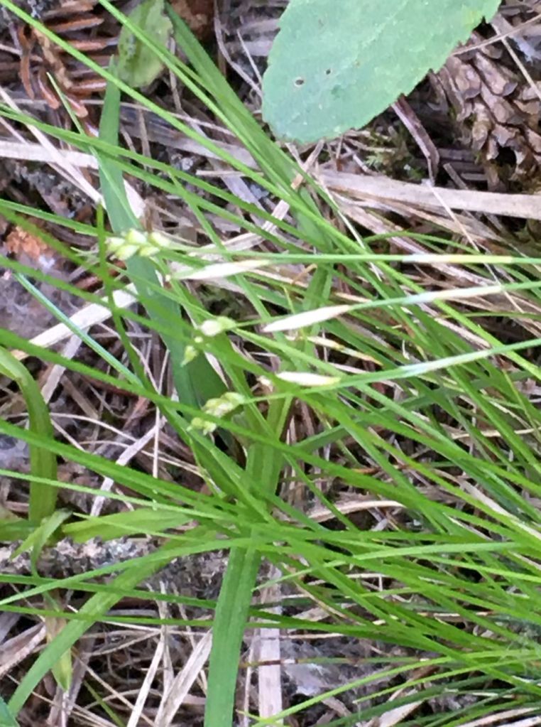
Bristle-leaf sedge (Carex eburnea)-Chedderville NA-2022-06-27-(PCotterill) 
Sparrow’s-egg lady’s-slipper (Cypripedium passerinum)-Chedderville NA-2022-06-27-(Manna Parseyan) 
Northern hedysarum (Hedysarum boreale subspecies boreale)-Chedderville NA-2022-06-27-(Manna Parseyan) 
Northern hedysarum alongside Clearwater River in Chedderville NA-2022-06-27-(Manna Parseyan) 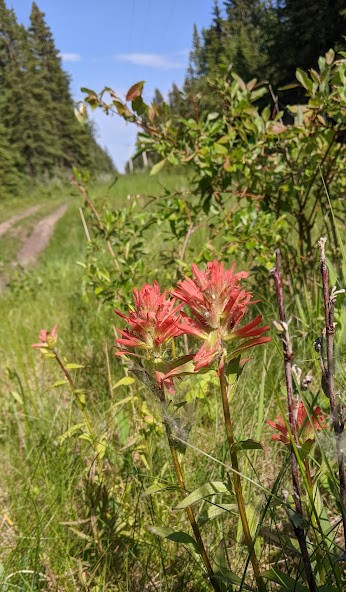
Vehicle track-Chedderville NA-2022-06-27-(Manna Parseyan)
