Located southwest of Rocky Mountain House, this NA consists of two parcels of land, separated by a distance of about 5 km. One is on Cow Creek and the other is at the north end of Cow Lake. An adjacent campsite on the west side is run by a local association.
- Map of the Area
- Other Information
- Biophysical Observations (via iNaturalist.ca)
- Site Statistics
- References
- Further Reading
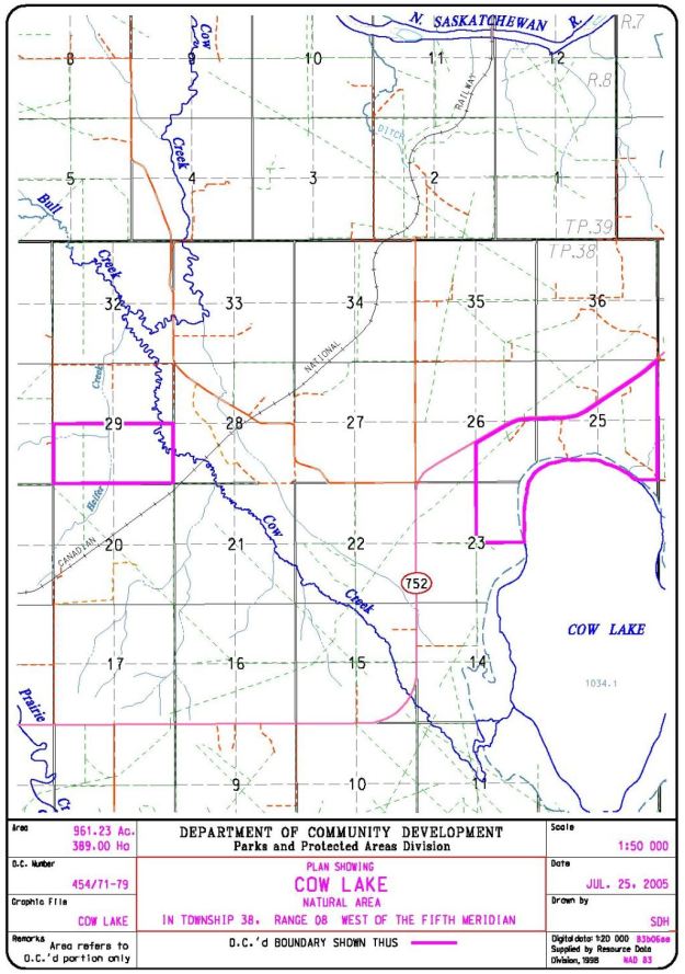
Map of the Area
Any maps and map views are for general information only. Do not rely on them for navigation or to determine legal boundaries.
Other Information
Cow Lake Natural Area contains mature mixedwood forests in upland areas, sedge meadows and willows along the lakeshore and black spruce-tamarack wetlands. Cow Lake is stocked with trout, Cow Creek with Brown Trout and Bull Trout (Alberta Parks website, 2012).
Cow Lake Recreational Area on the lake south of the NA is operated by a local association and is not administered by the Alberta Government. For information about the campground contact the association at 403-845-5851 or at Cow Lake Campground.
Biophysical Observations (via iNaturalist.ca)
Are you a member of iNaturalist.ca? It is free to join and you can help nature by making observations with your smart phone.
If there are no or only a few observations, how about visiting and adding some? While there, complete a site inspection report (but read the Site Inspections terms and conditions first).
Observations & Projects for this Natural Area
- Observations for this Natural Area.
- No iNaturalist Projects.
Site Statistics
| Site Name | Cow Lake |
| Site Type | Natural Area |
| Subtype | Order-in-council (OC) |
| Natural Region(s) | Lower Foothills |
| O.C. No. (Land Ref. Manual) | 454/71 |
| PASite ID (Map Ref #) | 117 |
| Site # (Parks Website) | |
| Total Area | 389.00 ha. (961.23 ac.) |
| Steward-Status | |
| Recreation Activities | fishing, hunting |
| IUCN | II |
| Operated By | Parks Division |
| Notes and Comments |
References
The following links are provided as a courtesy but are not verified or endorsed by SAPAA. Clicking on the link will cause you to leave the SAPAA website. Primary source of information is: Information & Facilities – Cow Lake Natural Area | Alberta Parks (2022-11-02).
