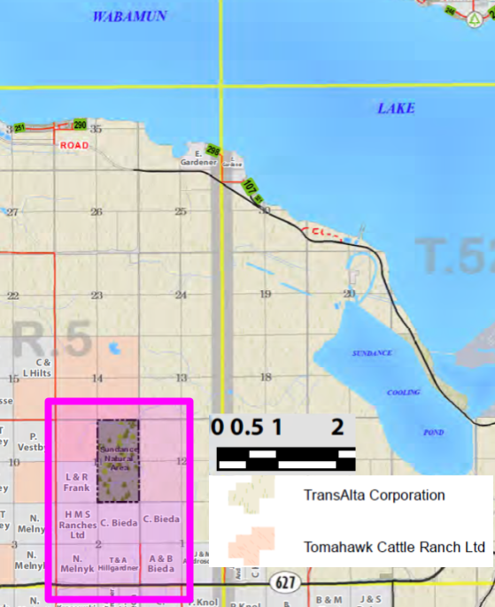
The Sundance Natural Area, about 6 km south of Wabamun Lake, is located within a coal lease area with restricted access.
- Map of the Area
- Other Information
- Biophysical Observations (via iNaturalist)
- Site Statistics
- References
- Further Reading
Map of the Area
Any maps and map views are for general information only. Do not rely on them for navigation or to determine legal boundaries.
Other Information
Sundance Natural Area has undulating topography dissected by a small creek. The vegetation is mainly open, fire-successional aspen forest with scattered balsam poplar, white spruce and pine over a dense shrub/herb understorey.
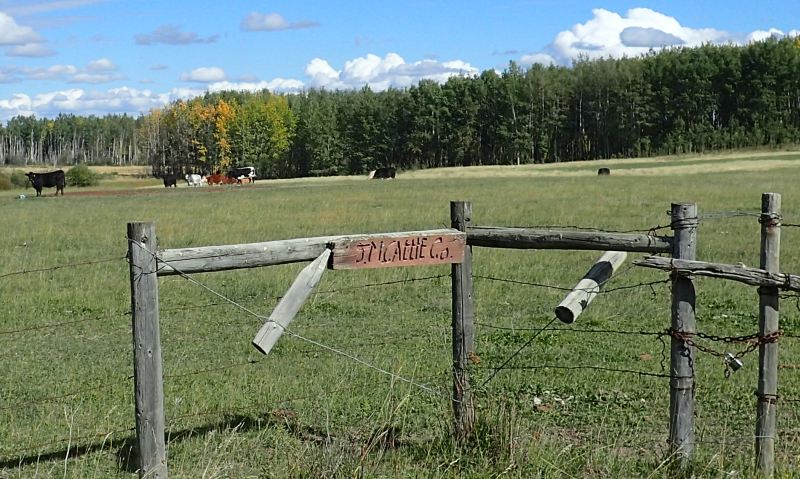
No public access. The NA is surrounded by private land, grazing or coal leases. As a result, access would need to be negotiated with the lease/land holders [1].
Sundance and Coal. Transalta has six coal-fired generating units at Sundance. The first was commissioned in 1970 and the last in 1980. Three of the six have since been retired. Two of the remaining have been converted to natural gas and the sixth is mothballed [2]. Previously, the coal for the units was sourced from the TransAlta Highvale Coal Mine that is adjacent to the power station [3].
Aboriginal Sundance. Alberta has several areas that relate to the Sundance ritual: a beach (Pigeon Lake), a canyon, a pass, a mountain range, a creek and a locality south of Wabamun Lake for which this NA is named. The Sundance ceremony was held by the Plains First Nations around the summer solstice. Because the dance involved self-torture, it was banned under the Indian Act from 1884 -1951 [4].
Biophysical Observations (via iNaturalist)
Are you a member of iNaturalist.ca? It is free to join and you can help nature by making observations with your smart phone.
If there are no or only a few observations, how about visiting and adding some? While there, complete a site inspection report (but read the Site Inspections terms and conditions first).
Observations & Projects for this Natural Area
- Observations for this Natural Area.
- No iNaturalist Projects.
Site Statistics
| Site Name | Sundance |
| Site Type | Natural Area |
| Subtype | Order-in-council (OC) |
| Natural Region(s) | Central Mixedwood |
| O.C. No. (Land Ref. Manual) | 454/71 |
| PASite ID (Map Ref #) | 52 |
| Site # (Parks Website) | 568 |
| Total Area | 129.05 ha. (318.88 ac.) |
| Steward-Status | |
| Recreation Activities | hunting, snowmobiling (off site) |
| IUCN | II |
| Operated By | Parks Division |
| Notes and Comments |

References
The following links are provided as a courtesy but are not verified or endorsed by SAPAA. Clicking on the link will cause you to leave the SAPAA website. Primary source of information is: Information & Facilities – Sundance Natural Area | Alberta Parks (All links accessed on 2025-05-08).
- Parkland County, Landownership Map
- TransAlta, Sundance
- Wikipedia, Sundance Power Station
- Aubrey, Merrily K., ed. Concise Place Names of Alberta. Calgary: University of Calgary Press, 2006, p. 311.
