Home to a colony of beavers, healthy bird populations and ungulates, Bilby has been an example of volunteer stewardship since the early 1980s. Remediation in 2024 has reversed years of OHV damage.
- Map of the Area
- Other Information
- Biophysical Observations (via iNaturalist.ca)
- Site Statistics
- References
- Site Visits
Map of the Area
Any maps and map views are for general information only. Do not rely on them for navigation or to determine legal boundaries.
Other Information
Upland aspen-balsam forest, with rose and beaked hazelnut shrubs, covers most of this site; small depressional areas contain willow wetland and black spruce peatland; grassy meadows and occasional stands of mature white spruce are also present. Bird species include Northern Oriole, Rose-breasted Grosbeak, Least Flycatcher, Red-tailed Hawk, Ruffed Grouse, Boreal Chickadee, Dark-eyed Junco, Hermit Thrush, Red-breasted Nuthatch, Savanna and Clay-coloured Sparrow. Ponds that form behind beaverdams provide habitat for Blue-winged Teal, Great Blue Heron and Spotted Sandpiper; standing dead trees along the creek provide nesting sites for woodpeckers and such tree-nesting ducks as Bufflehead and Common Goldeneye, as well as perches for hawks and owls (Alberta Parks website, 2012).
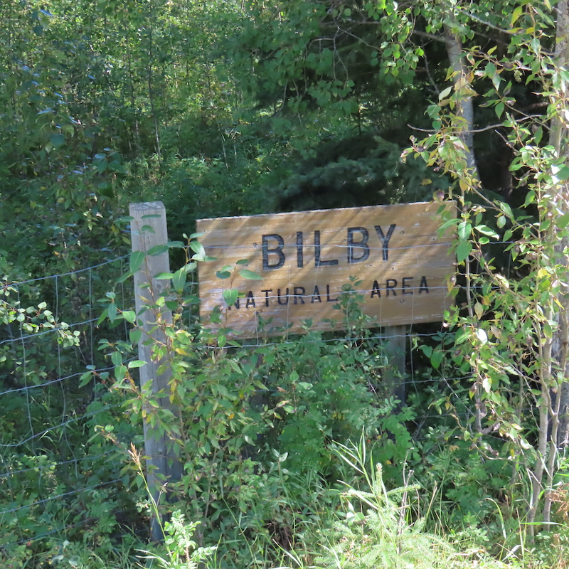
SITE OVERVIEW. Bilby Natural Area encompasses 121 ha southeast of the town of Onoway. Its official access points are at two openings on the west side of Range Road 14, or just south of the railroad tracks on Range Road 15. Kilini Creek is a major feature in the northwest part of the natural area. This wide, shallow stream winds through extensive sedge meadows and drains various dams, the work of generations of beavers [1, 2].
NAME ORIGIN. Bilby was originally a railway stop on the Canadian Northern Railway with a general store and a water and coal station for the trains. The track was laid 1912 and the hamlet was named for a company engineer called Wilby. Unfortunately, a spelling error resulted in the name Bilby. The one-room school house closed in 1952 and the train station ceased service in 1961. Signs about Bilby’s history can be found in the former townsite [3, 4].
KIDS CAMP. The natural area is to the south of the train tracks which run south of Devil’s (Matchayaw) Lake. Camps for kids and cabins were created in the area and were serviced by the train until passenger service ceased. While the hamlet, post office and general store have disappeared, an estate and the natural area continue to bear the name Bilby [5].
PAST OFF-HIGHWAY-VEHICLE (OHV) DAMAGE. A site visit in 2020 showed extensive damage by OHVs. Much of this damage was remediated in the summer of 2024. As well, the site was also an unofficial dump for the local community [6]. This has resulted in a number of vehicles having been abandoned at the site. Some were very weathered and others were newer, perhaps dumped in the last few years [7].
Biophysical Observations (via iNaturalist.ca)
Are you a member of iNaturalist.ca? It is free to join and you can help nature by making observations with your smart phone.
If there are no or only a few observations, how about visiting and adding some? While there, complete a site inspection report (but read the Site Inspections terms and conditions first).
Observations & Projects for this Natural Area
- Observations for this Natural Area.
- No iNaturalist Projects.
Site Statistics
| Site Name | Bilby |
| Site Type | Natural Area |
| Subtype | Order-in-council (OC) |
| Natural Region(s) | Dry Mixedwood |
| O.C. No. (Land Ref. Manual) | 378/87 |
| PASite ID (Map Ref #) | 55 |
| Site # (Parks Website) | 310.4 |
| Total Area | 121.17 ha. (299.41 ac.) |
| Steward-Status | |
| Recreation Activities | birding, hiking – front country |
| IUCN | II |
| Operated By | Parks Division |
| Notes and Comments |
References
The following links are provided as a courtesy but are not verified or endorsed by SAPAA. Clicking on the link will cause you to leave the SAPAA website. Primary source of information is: Bilby Natural Area | Alberta Parks (2025-04-08).
- A Profile of Bilby Natural Area, SAPAA Newsletter No. 23 October 2010, pp. 1-2.
- Steward Gertie Meyer, SAPAA Newsletter No. 22 May 2010, p.1, p. 5.
- “Bilby.” Placard at former townsite, n.d.
- Bilby Remembered, unpublished, n.d.
- Reflections on Lake Matchayan. Edmonton, Alberta: Lake Matchayan Book Club, 1982.
- Conversation of local walkers, 2024-09-28, F. Potter.
- Site Visit, 2020-12-11, unpublished, F.Potter.
Site Visits
- 2024-09-28, P. Potter (unpublished).
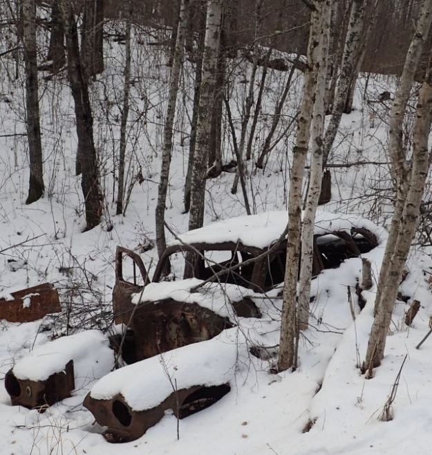
Abandoned car, Bilby Natural Area, 2020-12-11 (FPotter) 
Example of OHV Damage, Bilby Natural Area, 2020-12-11 (FPotter) 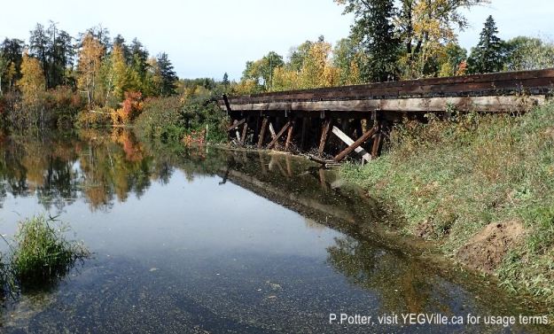
A Beaver dam created against a train trestle; nice of those humans to help!, 2024-09-28, Bilby NA, P. Potter. 
Reflections in the backwater of Kilini Creek, 2024-09-28, Bilby NA, P. Potter. 
Looking west along the cut line and atop the central hill in the NA, 2024-09-28, Bilby NA, P. Potter.

I have a soft spot for Bilby Natural Area. It has an interesting history of hope, dreams, and summer camps. It was also one of the first areas in which I saw the devastation that ATV’s can cause and thus the selfishness of past travelers in ‘consuming’ an area. Finally, it is close to metro Edmonton – good or bad depending on how selfish the visitor is.
LikeLike