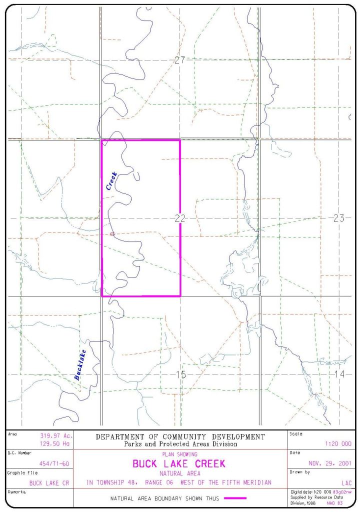
Buck Lake Creek Natural Area lies east of the Blue Rapids PRA near Drayton Valley and includes a creek with a steep, terraced embankment.
- Map of the Area
- Other Information
- Biophysical Observations (via iNaturalist.ca)
- Site Statistics
- References
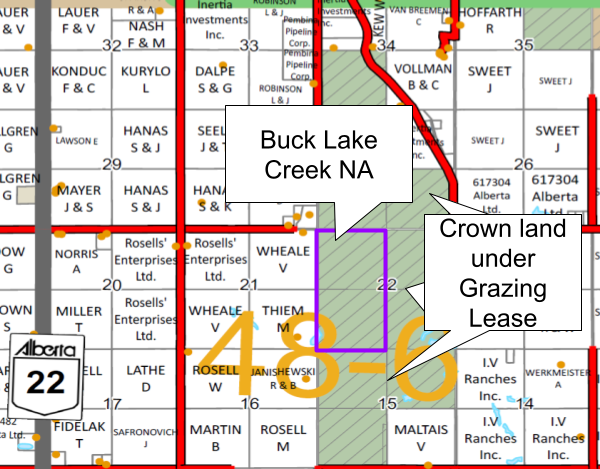
Map of the Area
Any maps and map views are for general information only. Do not rely on them for navigation or to determine legal boundaries.
Other Information
Buck Lake Creek NA surrounds a creek and steep terraced embankment. The area supports a variety of habitats, but the vegetation is mainly black spruce/Labrador tea peatland. The upland supports stands of mature aspen with balsam poplar and white spruce. There are also lodgepole pine-white spruce stands, areas of regenerating young aspen and wolf willow shrublands.
Biophysical Observations (via iNaturalist.ca)
Are you a member of iNaturalist.ca? It is free to join and you can help nature by making observations with your smart phone.
If there are no or only a few observations, how about visiting and adding some? While there, complete a site inspection report (but read the Site Inspections terms and conditions first).
Observations & Projects for this Natural Area
- Observations for this Natural Area.
- No iNaturalist Projects.
Site Statistics
| Site Name | Buck Lake Creek |
| Site Type | Natural Area |
| Subtype | Order-in-council (OC) |
| Natural Region(s) | Central Mixedwood; Dry Mixedwood |
| O.C. No. (Land Ref. Manual) | 454/71 |
| PASite ID (Map Ref #) | 290 |
| Site # (Parks Website) | 527 |
| Total Area | 129.50 ha. (319.97 ac.) |
| Steward-Status | |
| Recreation Activities | cross-country skiing, hiking – front country |
| IUCN | NA |
| Operated By | Parks Division |
| Notes and Comments |
References
The following links are provided as a courtesy but are not verified or endorsed by SAPAA. Clicking on the link will cause you to leave the SAPAA website. Primary source of information is: Government of Alberta – Information & Facilities – Buck Lake Creek Natural Area | Alberta Parks (accessed 2022-02-16).
