Three small, separate areas make up this NA where the Highwood River joins the Bow, southeast of Calgary.
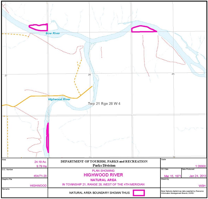
Map of the Area
Any maps and map views are for general information only. Do not rely on them for navigation or to determine legal boundaries.
Biophysical Observations (via iNaturalist)
Are you a member of iNaturalist.ca? It is free to join and you can help nature by making observations with your smart phone.
If there are no or only a few observations, how about visiting and adding some? While there, complete a site inspection report (but read the Site Inspections terms and conditions first).
Observations & Projects for this Natural Area
- Observations for this Natural Area.
- No iNaturalist Projects.
Other Information
Highwood River Natural Area (9.79 ha) includes islands in the Bow and Highwood Rivers frequented by Canada Geese and Great Blue Herons.
Ispasquehow, Tall Timber, or Highwood are names the smaller of these two rivers have been known by. The first is its original Stony name noted in 1792 by explorer Peter Fidler. This river flows at the same elevation as the surrounding prairie and the trees grow exceptionally tall on its banks [1].
Site Statistics
| Site Name | Highwood River |
| Site Type | Natural Area |
| Subtype | Order-in-council (OC) |
| Natural Region(s) | Foothills Fescue |
| O.C. No. (Land Ref. Manual) | 454/71 |
| PASite ID (Map Ref #) | 350 |
| Site # (Parks Website) | 512 |
| Total Area | 9.79 ha. (24.19 ac.) |
| Steward-Status | |
| Recreation Activities | canoeing/kayaking; fishing |
| IUCN | NA |
| Operated By | Parks Division |
| Notes and Comments |
References
The following links are provided as a courtesy but are not verified or endorsed by SAPAA. Clicking on the link will cause you to leave the SAPAA website. Primary source of information is: Information & Facilities – Highwood River Natural Area | Alberta Parks (All links accessed on 2026-02-19).
- Aubrey, Merrily K., ed. Concise Place Names of Alberta. Calgary: University of Calgary Press, 2006, p. 149.
