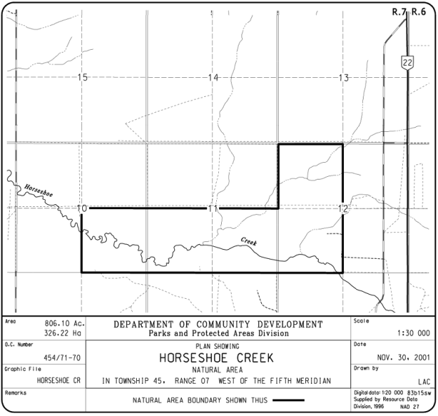
Just west of Highway 22 and 60 km southwest of Pigeon Lake, this Natural Area protects a portion of Horseshoe Creek. It is located about 5 km from the confluence with Wolf Creek in Central Alberta. Wolf Creek flows into the North Saskatchewan River near Drayton Valley.
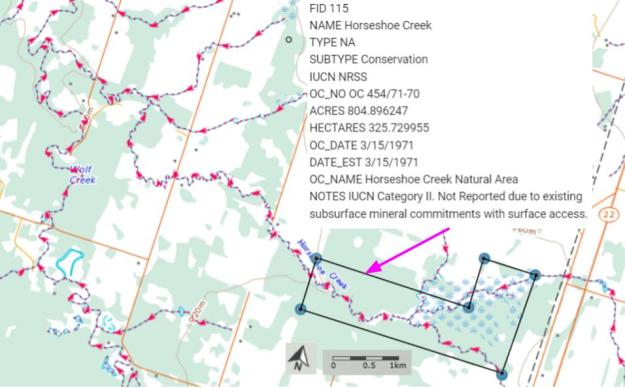
Map of the Area
Any maps and map views are for general information only. Do not rely on them for navigation or to determine legal boundaries.
Other Information
Horseshoe Creek Natural Area is a gently rolling upland with diverse wetlands, including numerous beaver ponds, jack pine-white spruce stands, aspen-jack pine mixedwoods, large mature aspen and mature white spruce. Along Horseshoe Creek are sedge meadows, willow shrublands, tamarack-black spruce/dwarf birch wetlands and beaver ponds (Alberta Parks website, 2012).
Biophysical Observations (via iNaturalist)
Are you a member of iNaturalist.ca? It is free to join and you can help nature by making observations with your smart phone.
If there are no or only a few observations, how about visiting and adding some? While there, complete a site inspection report (but read the Site Inspections terms and conditions first).
Observations & Projects for this Natural Area
- Observations for this Natural Area.
- No iNaturalist Projects.
Site Statistics
| Site Name | Horseshoe Creek |
| Site Type | Natural Area |
| Subtype | Order-in-council (OC) |
| Natural Region(s) | Lower Foothills |
| O.C. No. (Land Ref. Manual) | 454/71 |
| PASite ID (Map Ref #) | 300 |
| Site # (Parks Website) | 446 |
| Total Area | 326.22 ha. (806.10 ac.) |
| Steward-Status | |
| Recreation Activities | none noted |
| IUCN | II |
| Operated By | Parks Division |
| Notes and Comments |
References
The following links are provided as a courtesy but are not verified or endorsed by SAPAA. Clicking on the link will cause you to leave the SAPAA website. Primary source of information is Information & Facilities – Horseshoe Creek Natural Area | Alberta Parks (All links accessed on 2026-02-18).
