This irregularly shaped Natural Area, with impressive oxbow formations, is located on the north shore of the Battle River, about 40 km west of Wainwright.
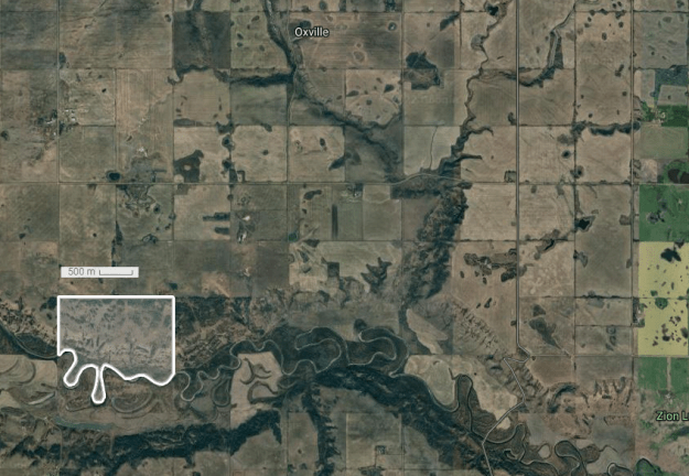
Map of the Area
Any maps and map views are for general information only. Do not rely on them for navigation or to determine legal boundaries.
Biophysical Observations (via iNaturalist)
Are you a member of iNaturalist.ca? It is free to join and you can help nature by making observations with your smart phone.
If there are no or only a few observations, how about visiting and adding some? While there, complete a site inspection report (but read the Site Inspections terms and conditions first).
Observations & Projects for this Natural Area
- Observations for this Natural Area.
- No iNaturalist Projects.
Site Statistics
| Site Name | Oxville (PNT) |
| Site Type | Natural Area |
| Subtype | Protective Notation (PNT) |
| Natural Region(s) | Central Parkland |
| O.C. No. (Land Ref. Manual) | N/A |
| PASite ID (Map Ref #) | 102 |
| Site # (Parks Website) | N/A |
| Total Area | 169.66 ha. (419.25 ac.) |
| Steward-Status | |
| Recreation Activities | |
| IUCN | |
| Operated By | |
| Notes and Comments |
References
Links are provided as a courtesy but are not verified or endorsed by SAPAA. Clicking on the link will cause you to leave the SAPAA website. Primary source of information is the Government of Alberta. (reviewed 2026-01-05)
