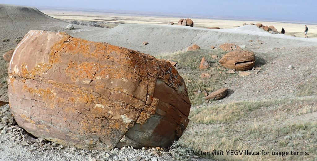
This site features large, spherical red sandstone concretions, some up to 2.5 meters in diameter, scattered across the landscape. This site includes eroded coulees and hoodoos, representing unique geological formations in Alberta.
- Map of the Area
- Other Information
- Biophysical Observations (via iNaturalist)
- Site Statistics
- References
- Further Reading
- Site Inspections
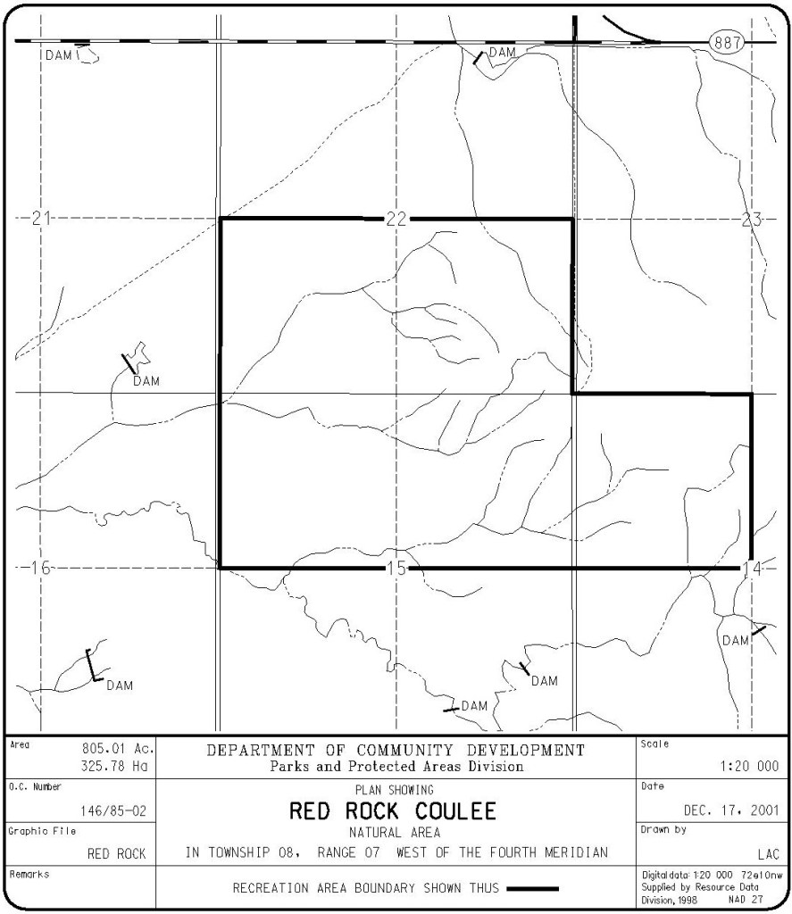
Map of the Area
Any maps and map views are for general information only. Do not rely on them for navigation or to determine legal boundaries.
Other Information
World Class Rocks. Red Rock Coulee Natural Area contains large, red, spherical sandstone concretions. These have eroded out of the softer bedrock and provide the best example of spheroid rock formations in Alberta. The concretions measure up to 2.5 m across and are considered to be among the largest in the world.
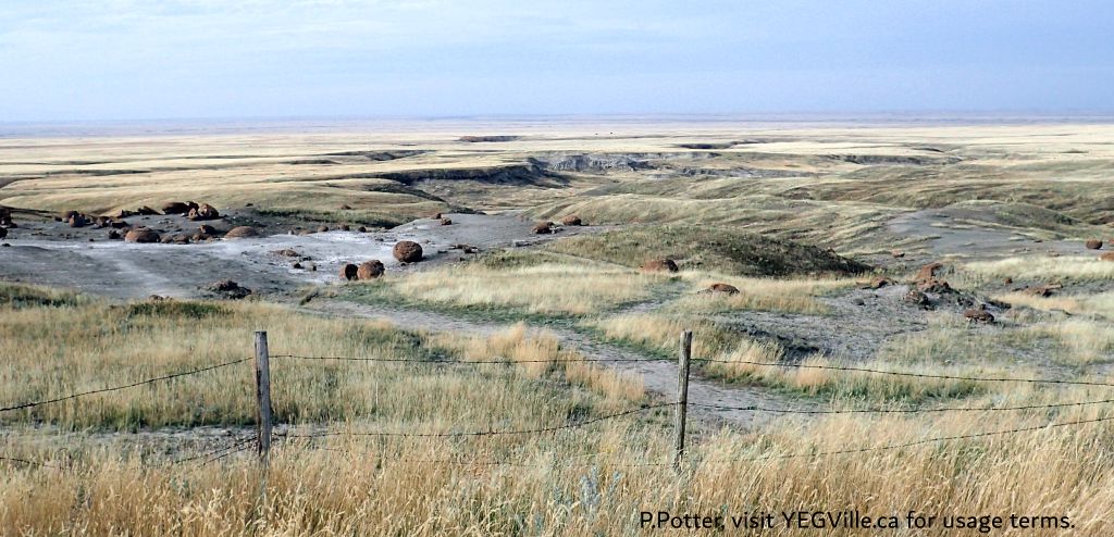
Seven Persons. The natural area consists of eroded, steep-sided coulees and a small upland of fescue-needlegrass vegetation. In places, hoodoos (columns of bedrock) have formed. This site lies in the Grassland Natural Region, Mixedgrass Subregion. A former glacial lakebed, this geology provides some of the best agricultural land in Alberta. The land drains west into the Seven Persons Coulee and eventually into the South Saskatchewan River.
WHAT IS A CONCRETION? Formed approximately 65 million years ago in ancient seas when mineral matter — shells, algae, bone, and so on — formed nuclei to which other matter adhered, the concretions are beautiful behemoths to behold. The ones that are cracked, broken or in various states of erosion actually show distinct rings that demonstrate the growth around a nucleus or concretion theory. Red Rock Coulee concretions are one of the most accessible but they are not unique to Alberta. Another Alberta example, a remote area on the Athabasca River at Grand Rapids, boasts some of the largest concretions in the world [2].
WHAT IS A COULEE? Coulee is a term applied rather loosely to different landforms that refer to a kind of valley or drainage zone. The word coulee comes from the Canadian French coulée, from the French couler meaning ‘to flow’ [3].
Biophysical Observations (via iNaturalist)
Are you a member of iNaturalist.ca? It is free to join and you can help nature by making observations with your smart phone.
If there are no or only a few observations, how about visiting and adding some? While there, complete a site inspection report (but read the Site Inspections terms and conditions first).
Observations & Projects for this Natural Area
- Observations for this Natural Area.
- No iNaturalist Projects.
Site Statistics
| Site Name | Red Rock Coulee |
| Site Type | Natural Area |
| Subtype | Order-in-council (OC) |
| Natural Region(s) | Dry Mixedgrass; Mixedgrass |
| O.C. No. (Land Ref. Manual) | 146/85 |
| PASite ID (Map Ref #) | 66 |
| Site # (Parks Website) | 422 |
| Total Area | 324.15 ha. (800.98 ac.) |
| Steward-Status | |
| Recreation Activities | Hiking – front country, wildlife viewing |
| IUCN | III |
| Operated By | Parks Division |
| Notes and Comments |
References
The following links are provided as a courtesy but are not verified or endorsed by SAPAA. Clicking on the link will cause you to leave the SAPAA website. Primary source of information is: Government of Alberta – Information & Facilities – Red Rock Coulee Natural Area | Alberta Parks (2025-04-16).
- Red Rock Coulee – Wikipedia.
- Dodging Snakes at Red Rock Coulee | Calgary Herald.
- Coulee – Wikipedia.
Further Reading
- BY-Red Rock Coulee – 2024-10-16 | YEG Ville.
- Site Profile: Red Rock Coulee. John Rintoul. Natural Areas Newsletter, January 1989, No. 5.
- Vancouver Sun, Why Red Rock Coulee is one of Alberta’s unsung geological treasures
- Seven Persons Creek | South East Alberta Watershed Alliance
- Cypress Hills – Alberta Wilderness Association
Site Inspections
Looking roughly West at the corner junction, Red Rock Coulee NA, 2024-10-16, P. Potter. 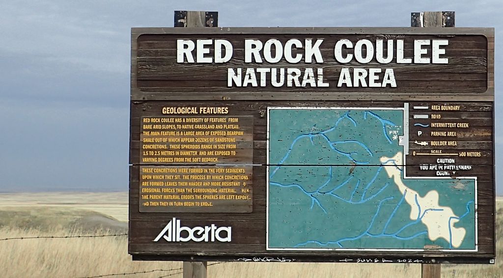
Information sign, Red Rock Coulee NA, 2024-10-16, P. Potter. Visitors explore the site, looking West, Red Rock Coulee NA, 2024-10-16, P. Potter. 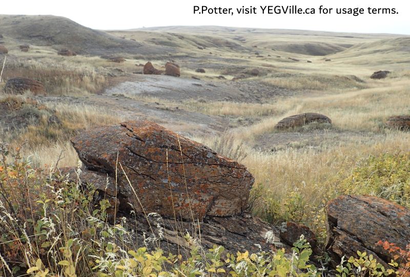
Looking South towards the valley; SE parcel, Red Rock Coulee NA, 2024-10-16, P. Potter. 
Looking North at a collection of concretions, Red Rock Coulee NA, 2024-10-16, P. Potter. 
Looking NW from the Parking lot across the fields below, Red Rock Coulee NA, 2024-10-16, P. Potter. 
Sign on HWY 887, looking NW, Red Rock Coulee NA, 2024-10-16, P. Potter. 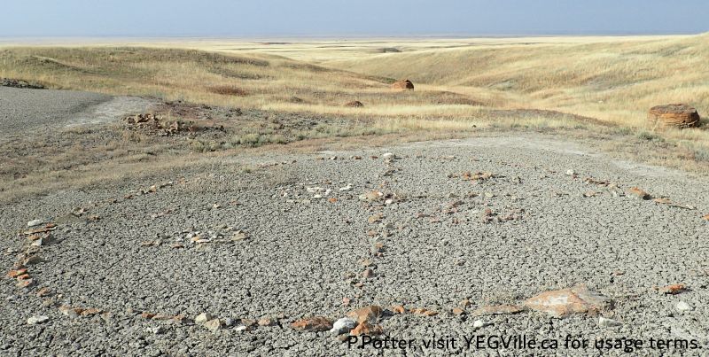
Looking West along the axis of a medicine wheel, Red Rock Coulee NA, 2024-10-16, P. Potter.

I have been looking forward to posting this site for about a year and am looking more forward to visiting. Basically big friggin’ rock balls in the middle of the prairie… I mean, how much cooler can you get than that!
LikeLike
Historically, this site was subject to vandalism but I did not see any which is heartening. The rocks are impressive considering they started as a leaf, bone, or other organic material. Worth a slight detour if near Medicine Hat.
LikeLike