Located west of Barrhead, due south of Thunder Lake Provincial Park and on Highway 18, Roselea Natural Area occupies nearly a full section of land (260 ha).
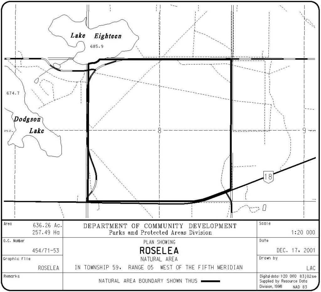
Map of the Area
Any maps and map views are for general information only. Do not rely on them for navigation or to determine legal boundaries.
Other Information
Roselea Natural Area encompasses a section of moderately rolling, pitted outwash plain covered mainly with aspen-balsam poplar-birch forest. The site lies in the Boreal Forest Natural Region, Central Mixedwood Subregion.
The nearby hamlet of Roselea is named for a place in England [1].
Biophysical Observations (via iNaturalist)
Are you a member of iNaturalist.ca? It is free to join and you can help nature by making observations with your smart phone.
If there are no or only a few observations, how about visiting and adding some? While there, complete a site inspection report (but read the Site Inspections terms and conditions first).
Observations & Projects for this Natural Area
- Observations for this Natural Area.
- No iNaturalist Projects.
Site Statistics
| Site Name | Roselea |
| Site Type | Natural Area |
| Subtype | Order-in-council (OC) |
| Natural Region(s) | Central Mixedwood |
| O.C. No. (Land Ref. Manual) | 454/71 |
| PASite ID (Map Ref #) | 285 |
| Site # (Parks Website) | 565 |
| Total Area | 257.49 ha/636.26 ac. |
| Steward-Status | |
| Recreation Activities | Cross-country skiing, Hiking – front country, Horseback riding |
| IUCN | II |
| Operated By | Parks Division |
| Notes and Comments |
References
The following links are provided as a courtesy but are not verified or endorsed by SAPAA. Clicking on the link will cause you to leave the SAPAA website. Primary source of information is: Government of Alberta – Information & Facilities – Roselea Natural Area | Alberta Parks (2024-04-23).
- Peel Library. Geographic Board of Canada, Place-Names of Alberta (1928), p. 110. Accessed 2022-01-23. http://peel.library.ualberta.ca/bibliography/5240.html.

Named for a hamlet in England, Roselea is one of the many natural areas easily in driving distance from Edmonton. A day trip from the city to see a bit of nature!
LikeLike