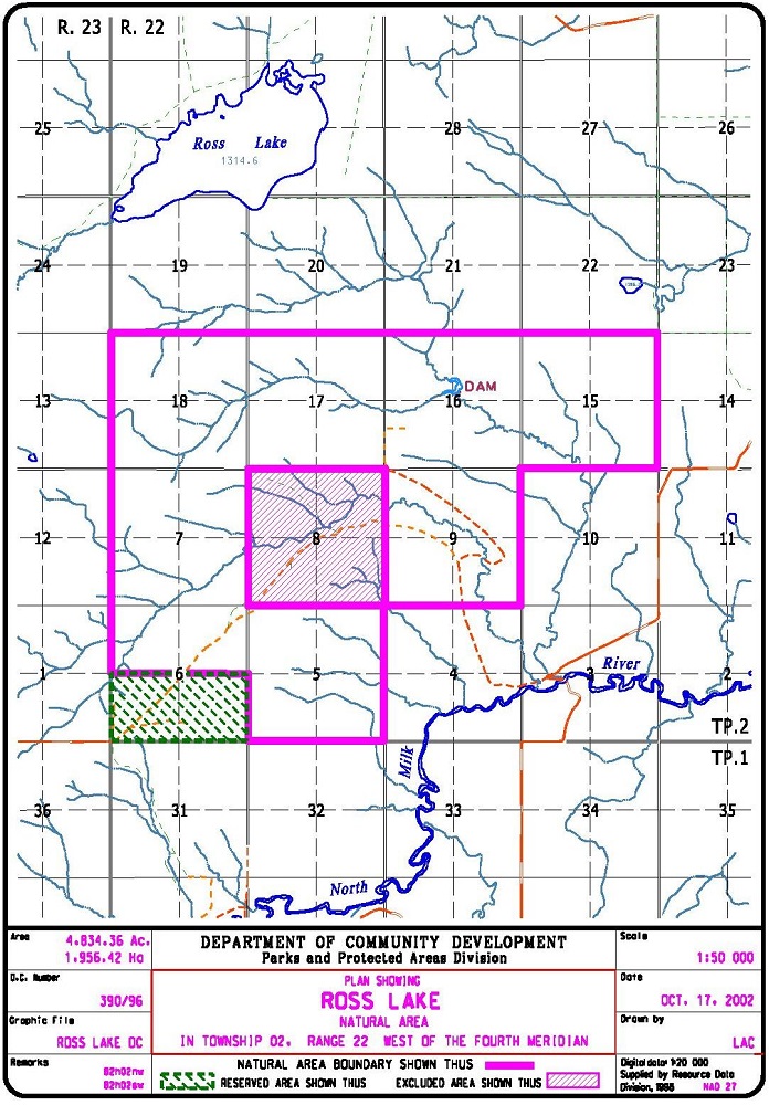
This NA is located in the North Milk River watershed, just a few kilometres south of Ross Lake itself. It is composed of a large OC portion, with a smaller PNT site in the southwest corner.
Map of the Area
Any maps and map views are for general information only. Do not rely on them for navigation or to determine legal boundaries.
Other Information
Ross Lake Natural Area, south of Magrath and approximately 10 km north of the Montana border, includes the largest Crown-owned area of foothills fescue grassland in Alberta. Parts of the area were not glaciated during the last Ice Age and, as a result, the site contains a number of rare plants and insects. This natural area was established as part of the Special Places Program (Alberta Parks website, 2012).
A central quarter section of this site, traversed by the trail, is private land.
Biophysical Observations (via iNaturalist)
Are you a member of iNaturalist.ca? It is free to join and you can help nature by making observations with your smart phone.
If there are no or only a few observations, how about visiting and adding some? While there, complete a site inspection report (but read the Site Inspections terms and conditions first).
Observations & Projects for this Natural Area
- Observations for Ross Lake (OC)
- Observations for Ross Lake (PNT)
- No iNaturalist Projects.
Site Statistics
| Site Name | Ross Lake (OC) |
| Site Type | Natural Area |
| Subtype | Order-in-council (OC) |
| Natural Region(s) | Foothills Fescue |
| O.C. No. (Land Ref. Manual) | 390/96 |
| PASite ID (Map Ref #) | 488 |
| Site # (Parks Website) | 515 |
| Total Area | 1956.42 ha. (4834.36 ac.) |
| Steward-Status | |
| Recreation Activities | none noted |
| IUCN | VI |
| Operated By | Parks Division |
| Notes and Comments |
| Site Name | Ross Lake (PNT) |
| Site Type | Natural Area |
| Subtype | Protective Notation (PNT) |
| Natural Region(s) | Foothills Fescue |
| O.C. No. (Land Ref. Manual) | N/A |
| PASite ID (Map Ref #) | 488 |
| Site # (Parks Website) | N/A |
| Total Area | 128.16 ha. (316.70 ac.) |
| Steward-Status | |
| Recreation Activities | |
| IUCN | II*6 |
| Operated By | |
| Notes and Comments |
References
The following links are provided as a courtesy but are not verified or endorsed by SAPAA. Clicking on the link will cause you to leave the SAPAA website. Primary source of information is: Information & Facilities – Ross Lake Natural Area | Alberta Parks. All websites accessed 2022-11-12.
