This quarter-section size Natural Area, located on Strawberry Creek about 45 km west of Leduc, is named after a former mayor of Leduc.
- Map of the Area
- Biophysical Observations (via iNaturalist)
- Other Information
- Site Statistics
- References
- Further Reading
- Site Visits
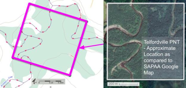
Map of the Area
Any maps and map views are for general information only. Do not rely on them for navigation or to determine legal boundaries.
Biophysical Observations (via iNaturalist)
Are you a member of iNaturalist.ca? It is free to join and you can help nature by making observations with your smart phone.
If there are no or only a few observations, how about visiting and adding some? While there, complete a site inspection report (but read the Site Inspections terms and conditions first).
Observations & Projects for this Natural Area
- Observations for this Natural Area.
- No iNaturalist Projects.
Other Information
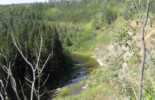
The land that surrounds Strawberry Creek in the Telfordville Natural Area is thick with mature aspen, peppered with balsam poplar and white spruce, and reinforced with diverse shrub and herb layers [1]. The surrounding land is private [2]. Access to the PNT is possible from the northeast corner [3].
Telfordville is Named after Robert Telford, former Leduc mayor and member of the Legislative Assembly of Alberta, 1905-1913 [4].
Site Statistics
| Site Name | Telfordville (PNT) |
| Site Type | Natural Area |
| Subtype | Protective Notation (PNT) |
| Natural Region(s) | Dry Mixedwood |
| O.C. No. (Land Ref. Manual) | N/A |
| PASite ID (Map Ref #) | 455 |
| Site # (Parks Website) | N/A |
| Total Area | 64.35 ha. (159.02 ac.) |
| Steward-Status | |
| Recreation Activities | |
| IUCN | |
| Operated By | |
| Notes and Comments |
References
The following links are provided as a courtesy but are not verified or endorsed by SAPAA. Clicking on the link will cause you to leave the SAPAA website. Primary source of information is the Government of Alberta (All links accessed on 2022-12-29).
- Von Hauff, Donna. Alberta’s Parks – Our Legacy. Edmonton: Alberta Recreation, Parks & Wildlife Foundation, 1992, p. 118.
- Leduc County, Land Ownership Map
- Exploring Telfordville (H. Taube), SAPAA Newsletter No. 46 April 2023, p.3.
- Wikipedia, Telfordville
