This site is another quarter-section-sized NA with no road access. It is located 20 km southwest of the south end of Pigeon Lake, about 2 km northeast of the TWP 452/RR 24 intersection. It is located near to other natural areas representing the Boreal Forest Natural Region can be found close by.
- Map of the Area
- Other Information
- Biophysical Observations (via iNaturalist.ca)
- Site Statistics
- References
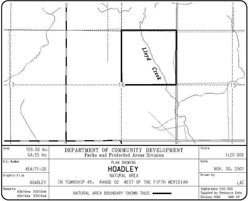
Map of the Area
Any maps and map views are for general information only. Do not rely on them for navigation or to determine legal boundaries.
Other Information
Hoadley Natural area encompasses a glacial meltwater channel now occupied by Lloyd Creek. Vegetation includes black spruce-larch-Sphagnum wetlands and upland aspen & balsam poplar forest; good wildlife habitat. This site lies in the Boreal Forest Natural Region, Dry Mixedwood Sub-region (Alberta Parks web site, 2012).
Nearby sites include Lloyd Creek and Winfield Natural Areas, Town Creek, and Battle Lake Natural Area.
Biophysical Observations (via iNaturalist.ca)
Are you a member of iNaturalist.ca? It is free to join and you can help nature by making observations with your smart phone.
If there are no or only a few observations, how about visiting and adding some? While there, complete a site inspection report (but read the Site Inspections terms and conditions first).
Observations & Projects for this Natural Area
- Observations for this Natural Area.
- No iNaturalist Projects.
Site Statistics
| Site Name | Hoadley |
| Site Type | Natural Area |
| Subtype | Order-in-council (OC) |
| Natural Region(s) | Central Mixedwood |
| O.C. No. (Land Ref. Manual) | 454/71 |
| PASite ID (Map Ref #) | 377 |
| Site # (Parks Website) | 445 |
| Total Area | 65.00 ha. (160.62 ac.) |
| Steward-Status | |
| Recreation Activities | none noted |
| IUCN | II |
| Operated By | Parks Division |
| Notes and Comments |
References
The following links are provided as a courtesy but are not verified or endorsed by SAPAA. Clicking on the link will cause you to leave the SAPAA website. Information & Facilities – Hoadley Natural Area | Alberta Parks (2026-02-19)

One of the upsides of winter is the ability to walk on water. Okay, it is not so much a miracle as it is frozen. This Natural Area may need to wait until there is a good freeze as there is no apparent road access.
LikeLike