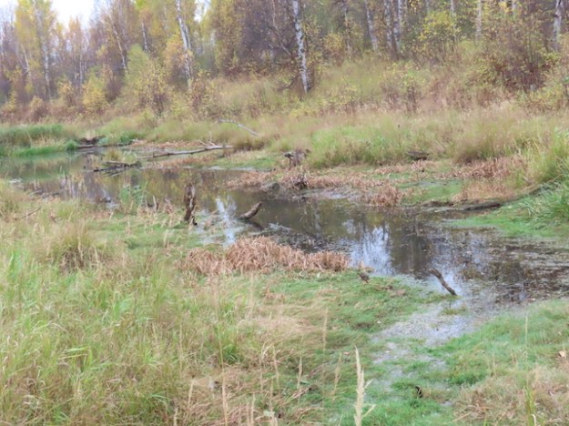
This PNT Natural Area is approximately 3 km northwest of Pigeon Lake. It is likely so named because it on the height of land that divides the Strawberry Creek watershed of the North Saskatchewan River to the north from drainage to the south. The unnamed creek in the photo is actually flowing south towards Pigeon Lake.
- Map of the Area
- Other Information
- Biophysical Observations (via iNaturalist)
- Site Statistics
- Site Inspection Reports
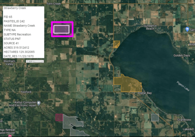
Map of the Area
Any maps and map views are for general information only. Do not rely on them for navigation or to determine legal boundaries.
Other Information
Rare plants. The PNT consists of an interesting mix of forest and riparian communities. It also contains several rare plant species, including Clinton’s bulrush (Tricophorum clintonii) and stalked sedge (Carex pedunculata), both of which have also been found on the shores of Pigeon Lake. Moonworts (Botrychium species) also occur [1].
Cree translation. Strawberry Creek is a translation from the original Cree [2].
Other protected areas. The Pigeon Lake Provincial Park sites and Mount Butte Natural Area are to the southeast and south, respectively.
Biophysical Observations (via iNaturalist)
Are you a member of iNaturalist.ca? It is free to join and you can help nature by making observations with your smart phone.
If there are no or only a few observations, how about visiting and adding some? While there, complete a site inspection report (but read the Site Inspections terms and conditions first).
Observations & Projects for this Natural Area
- Observations for this Natural Area.
- No iNaturalist Projects.
Site Statistics
| Site Name | Strawberry Creek (PNT) |
| Site Type | Natural Area |
| Subtype | Protective Notation (PNT) |
| Natural Region(s) | Central Mixedwood |
| O.C. No. (Land Ref. Manual) | N/A |
| PASite ID (Map Ref #) | 242 |
| Site # (Parks Website) | N/A |
| Total Area | 129.30 ha. (319.51 ac.) |
| Steward-Status | |
| Recreation Activities | |
| IUCN | |
| Operated By | |
| Notes and Comments |


References
The following links are provided as a courtesy but are not verified or endorsed by SAPAA. Clicking on the link will cause you to leave the SAPAA website. Primary source of information is the Government of Alberta – (All links accessed on 2023-01-02).
- Field visit by P. Cotterill, on 2009.07.20. Pers. Comm.
- Peel 5240: Geographic Board of Canada, Place Names of Alberta (1928)
